MyTopo
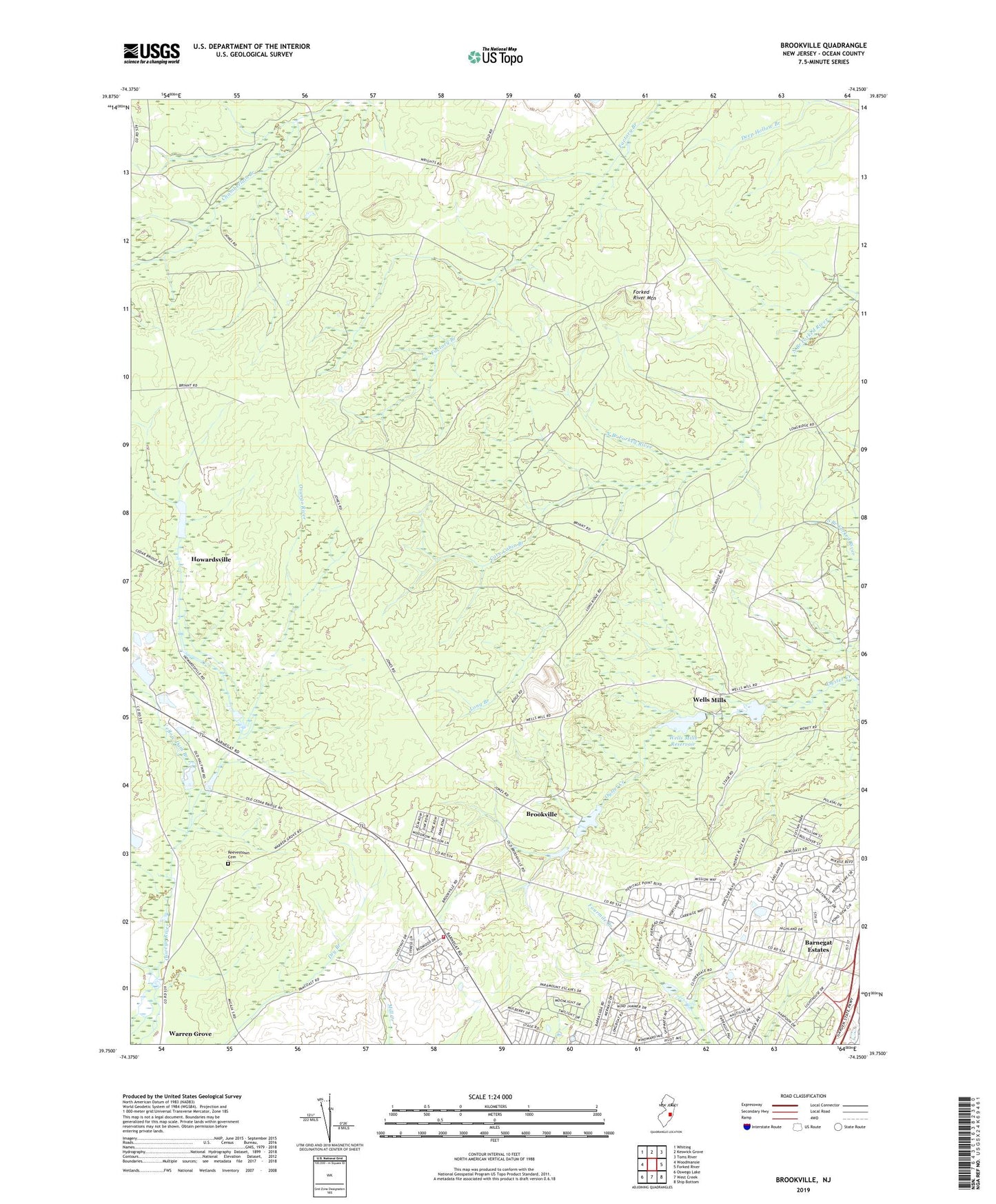
Brookville New Jersey US Topo Map
Couldn't load pickup availability
2019 topographic map quadrangle Brookville in the state of New Jersey. Scale: 1:24000. Based on the newly updated USGS 7.5' US Topo map series, this map is in the following counties: Ocean. The map contains contour data, water features, and other items you are used to seeing on USGS maps, but also has updated roads and other features. This is the next generation of topographic maps. Printed on high-quality waterproof paper with UV fade-resistant inks.
Quads adjacent to this one:
West: Woodmansie
Northwest: Whiting
North: Keswick Grove
Northeast: Toms River
East: Forked River
Southeast: Ship Bottom
South: West Creek
Southwest: Oswego Lake
Contains the following named places: Aserdaten, Barnegat Estates, Barnegat Volunteer Fire Company 1 Station 11 - 2, Bonds Half-Way House, Brighton at Barnegat Mobile Home Park, Brookville, Cave Cabin Branch, Forked River Mountain, Good Will Camp, Hi-Way Lodge, Howardsville, Lacey, Long Branch, Mill Dam, Mill Pond, Pinewood Estates Mobile Home Park, Rainbow Gun Club, Reevestown Cemetery, Township of Barnegat, Township of Lacey, Wells Mills, Wells Mills County Park, Wells Mills Reservoir, Wells Mills Reservoir Dam, WQNJ-FM (Ocean Acres), Yellow Dam Branch, ZIP Codes: 08005, 08731