MyTopo
Buena New Jersey US Topo Map
Couldn't load pickup availability
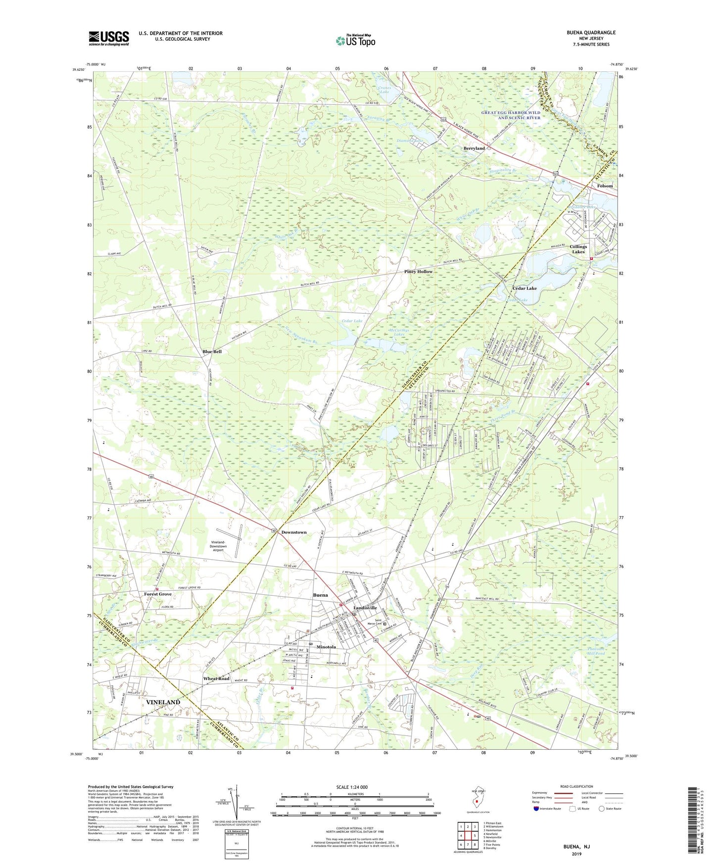
2019 topographic map quadrangle Buena in the state of New Jersey. Scale: 1:24000. Based on the newly updated USGS 7.5' US Topo map series, this map is in the following counties: Gloucester, Atlantic, Cumberland, Camden. The map contains contour data, water features, and other items you are used to seeing on USGS maps, but also has updated roads and other features. This is the next generation of topographic maps. Printed on high-quality waterproof paper with UV fade-resistant inks.
Quads adjacent to this one:
West: Newfield
Northwest: Pitman East
North: Williamstown
Northeast: Hammonton
East: Newtonville
Southeast: Dorothy
South: Five Points
Southwest: Millville
Contains the following named places: Als Landing Strip, Bellone's Nursery, Berryland, Blue Bell, Borough of Buena, Braddock Lake, Braddock Lake Dam, Brimfield Crossing, Buena, Buena Borough Police, Buena Post Office, Buena Regional High School, Cains Mill Lake, Cains Mill Pond Dam, Cedar Lake, Cedar Lake Dam, Cleary School, Collings Lake Elementary School, Collings Lake Pit, Collings Lakes, Collings Lakes Census Designated Place, Collings Lakes Volunteer Fire Department, Cranes Lake, Cranes Lake Dam, Diamond Lake, Diamond Lake Dam, Downstown, Faraway Branch, Forest Grove, Forest Grove Volunteer Fire Company, Friendship Church, Hospitality Lake, John C Milanesi Elementary School, Johnstone Elementary School, Lake George, Lake George Dam, Landisville, Landisville Post Office, Landisville Volunteer Fire Company 1, Long Branch, Main Road Elementary School, Marsh Lake, McCarthys Lakes, Minotola, Minotola Post Office, Minotola Volunteer Fire Company, New Squankum Branch, Newtonville Volunteer Fire Company, Our Lady of Mercy Academy School, Pancoast Mill Pond, Piney Hollow, Piney Hollow Airfield, Saint Marys Cemetery, Saint Michaels Church, Sandor Farms Airstrip, Township of Buena Vista, Vineland-Downstown Airport, Wheat Road, White Oak Branch, William B Donini Elementary School, ZIP Codes: 08310, 08326, 08341, 08344