MyTopo
Newtonville New Jersey US Topo Map
Couldn't load pickup availability
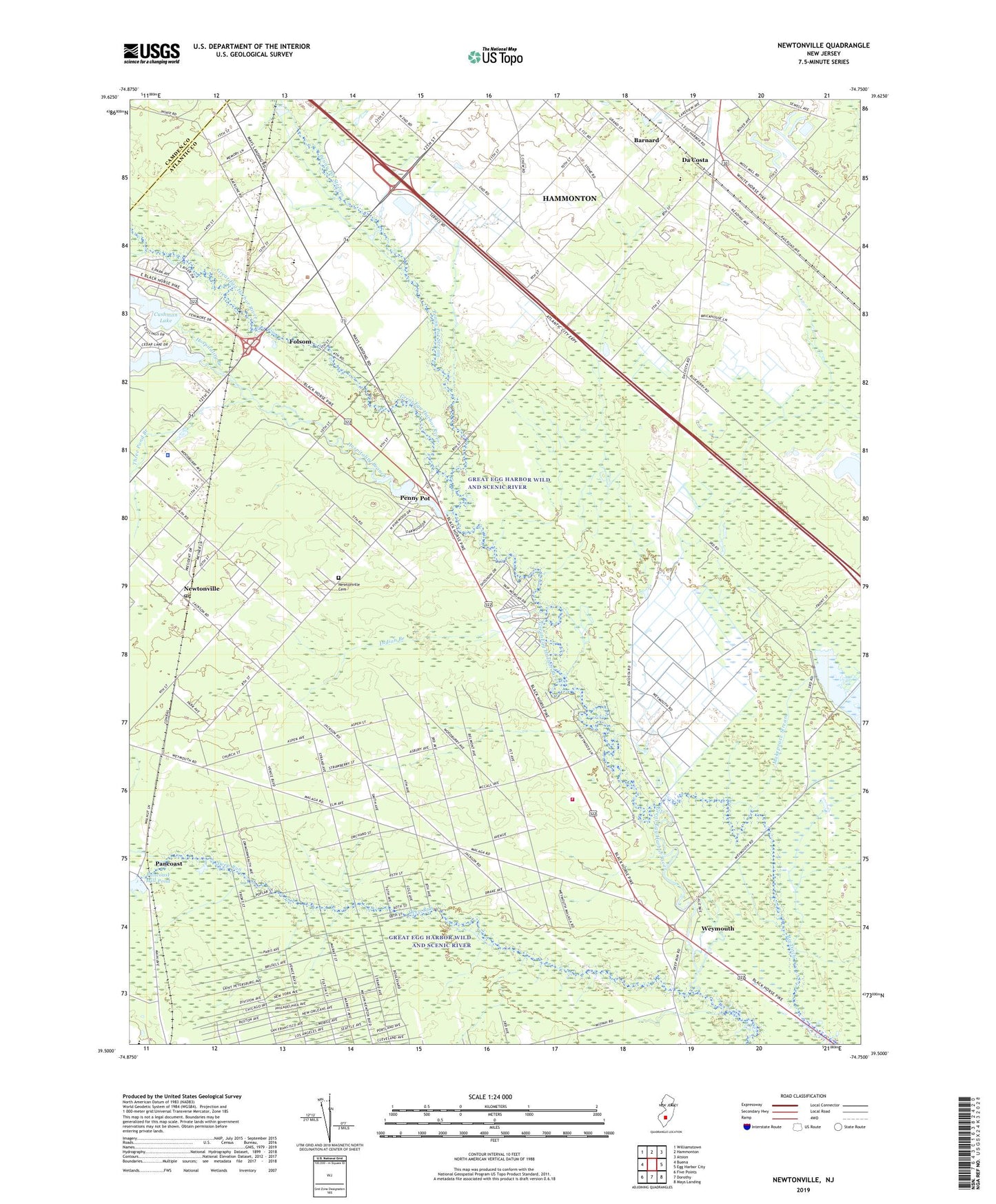
2023 topographic map quadrangle Newtonville in the state of New Jersey. Scale: 1:24000. Based on the newly updated USGS 7.5' US Topo map series, this map is in the following counties: Atlantic, Camden. The map contains contour data, water features, and other items you are used to seeing on USGS maps, but also has updated roads and other features. This is the next generation of topographic maps. Printed on high-quality waterproof paper with UV fade-resistant inks.
Quads adjacent to this one:
West: Buena
Northwest: Williamstown
North: Hammonton
Northeast: Atsion
East: Egg Harbor City
Southeast: Mays Landing
South: Dorothy
Southwest: Five Points
This map covers the same area as the classic USGS quad with code o39074e7.
Contains the following named places: Barnard, Bethlehem Church, Big Ditch, Borough of Folsom, Cushman Lake, Cushman Lake Dam, Da Costa, Deep Run, First Union Church, Folsom, Folsom Airport, Folsom Elementary School, Folsom Volunteer Fire Company, Great Egg Harbor Wild and Scenic River, Green Market Farms, Hospitality Branch, Indian Branch, Lake Albert, Lake Albert Dam, Little Mill Creek, Makepeace Lake Dam, Mount Zion Church, New Jersey State Police Troop A Buena Vista Headquarters, Newtonville, Newtonville Cemetery, Newtonville Census Designated Place, Newtonville Post Office, Pancoast, Pancoast Mill Pond Dam, Penny Pot, Penny Pot Stream, Saint Augustine Preparatory School, Saint James Church, Three Pond Branch, Weymouth, Weymouth Volunteer Fire Company, ZIP Code: 08346