MyTopo
Cassville New Jersey US Topo Map
Couldn't load pickup availability
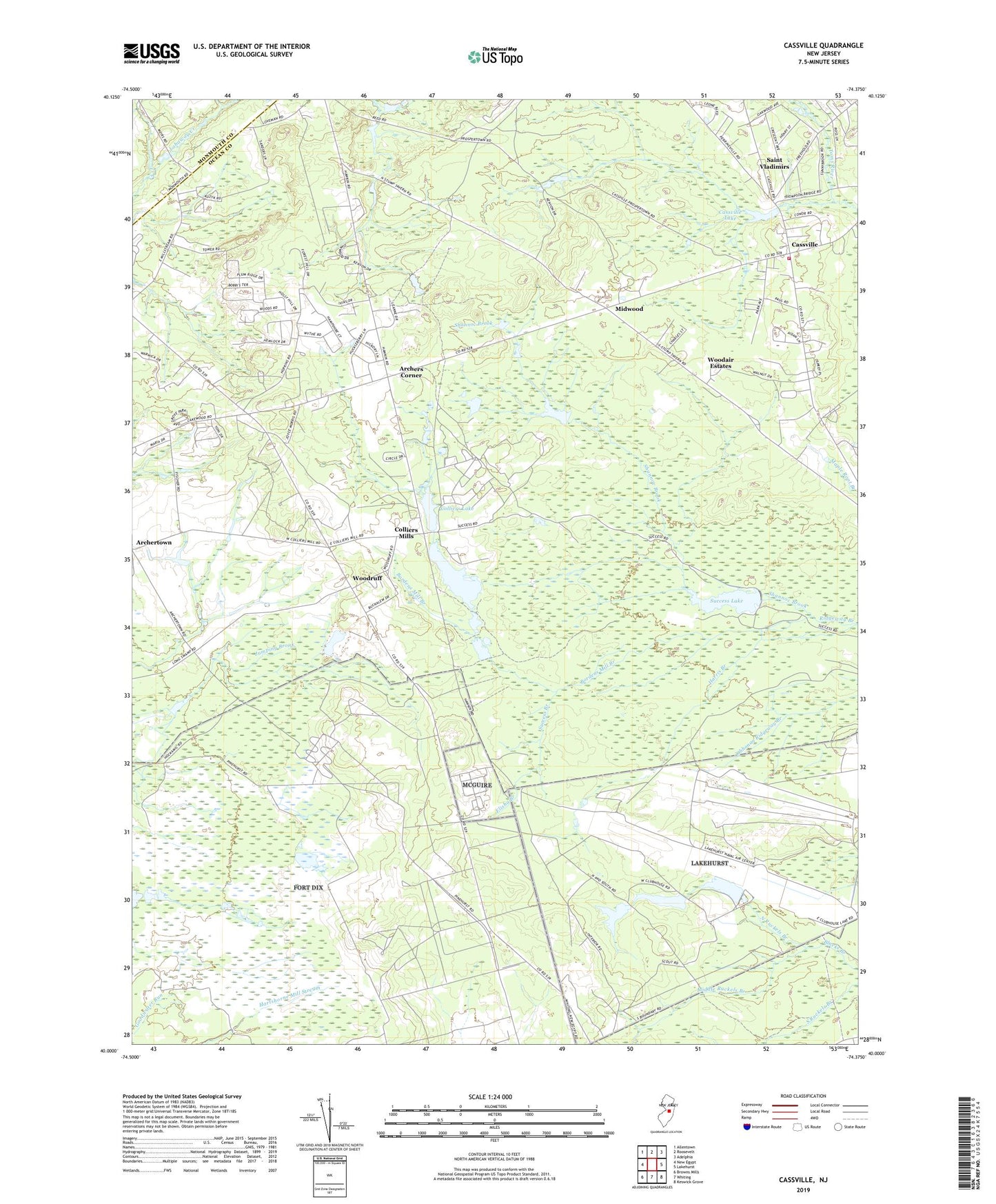
2019 topographic map quadrangle Cassville in the state of New Jersey. Scale: 1:24000. Based on the newly updated USGS 7.5' US Topo map series, this map is in the following counties: Ocean, Monmouth. The map contains contour data, water features, and other items you are used to seeing on USGS maps, but also has updated roads and other features. This is the next generation of topographic maps. Printed on high-quality waterproof paper with UV fade-resistant inks.
Quads adjacent to this one:
West: New Egypt
Northwest: Allentown
North: Roosevelt
Northeast: Adelphia
East: Lakehurst
Southeast: Keswick Grove
South: Whiting
Southwest: Browns Mills
Contains the following named places: Archers Corner, Archertown, Bordens Mill Branch, Cassville, Cassville Crossroads Historic District, Cassville Dam, Cassville Lake, Cassville Volunteer Fire Company Station 56, Colliers Lake, Colliers Mills, Colliers Mills Dam, Colliers Mills Heliport, Colliers Mills Wildlife Management Area, Elisha Branch, Gil Putnam Memorial Park, Harris Branch, Jackson State Forest, Middle Ruckels Branch, Midwood, New Jersey Wildlife and Game Refuge, North Ruckels Branch, Plumsted Pit, Rava Farms School, Saint Vladimir Memorial Church, Saint Vladimirs, Shannoc Brook, Success, Success Branch, Success Lake, Success Lake Dam, Township of Plumsted, Woodair Estates, Woodruff