MyTopo
Browns Mills New Jersey US Topo Map
Couldn't load pickup availability
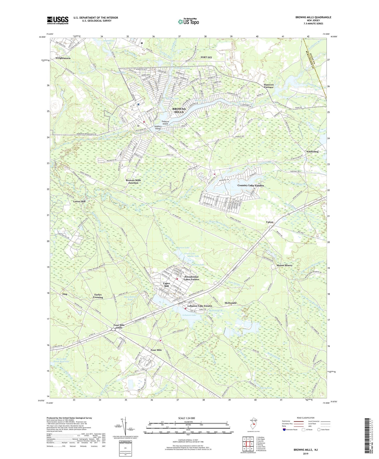
2023 topographic map quadrangle Browns Mills in the state of New Jersey. Scale: 1:24000. Based on the newly updated USGS 7.5' US Topo map series, this map is in the following counties: Burlington, Ocean. The map contains contour data, water features, and other items you are used to seeing on USGS maps, but also has updated roads and other features. This is the next generation of topographic maps. Printed on high-quality waterproof paper with UV fade-resistant inks.
Quads adjacent to this one:
West: Pemberton
Northwest: Columbus
North: New Egypt
Northeast: Cassville
East: Whiting
Southeast: Woodmansie
South: Chatsworth
Southwest: Indian Mills
This map covers the same area as the classic USGS quad with code o39074h5.
Contains the following named places: Adams Lake, Aletta Crichton Elementary School, Alexander Denbo Elementary School, Amphibious Lake, Amphibious Lake Dam, Baffin Brook, Big Pine Lake, Bisphams Mill Creek, Bowkers Run, Browns Mills, Browns Mills Census Designated Place, Browns Mills Emergency Squad, Browns Mills Fire Company 1, Browns Mills Junction, Browns Mills Post Office, Bucks Cove Run, Burrs Mill Brook Reservoir, Cooper Branch, Country Lake, Country Lake Estates, Country Lake Estates Census Designated Place, Country Lakes Emergency Squad, Country Lakes Volunteer Fire Company 1, Cranberry Branch, Deborah Heart and Lung Medical Center, Deborah Sanatorium, Deep Hollow Pond, Deverson Lake, Earlys Crossing, Federal Correctional Institution - Fort Dix, Four Mile, Four Mile Circle, Gaunts Brook, Goodwater Run, Grant Lake, Gum Spring, Hanover Furnace, Hanover Lake, Hanover Lake Dam, Harker Wylie Elementary School, Hartshorne Mill Stream, Isaiah Haines Elementary School, Jacks Run, Joseph Stackhouse Elementary School, Larkins Run, Laurel Hill School, Lebanon Forest Dam Number One, Lebanon Lake, Lebanon Lake Dam, Lebanon Lake Estates, Lebanon Lakes Volunteer Fire Company, Little Pine Lake, Lower Mill, LZ 1 NLDC Heliport, Manson Lake, Mary Ann Furnace, McDonald, McDonalds Branch, Mid - State Correctional Facility, Middle Branch Mount Misery Brook, Mirror Lake, Mirror Lake Dam, Monroe Lake, Mount Misery, Mount Misery Brook, New Jersey Forest Fire Service B2, New Jersey Forest Fire Service B6, New Lisbon Developmental Center Ambulance, Newbold Run, North Branch Mount Misery Brook, Ong, Ong Run, Pakim Pond, Pole Bridge Branch, Presidential Lake Estates, Presidential Lakes, Presidential Lakes Estates, Presidential Lakes Estates Census Designated Place, Presidential Lakes Fire and Rescue, Shinns Branch, Soldiers Island, South Branch Mount Misery Brook, The Pine Barrens, Township of Pemberton, Treasure Island, Upper Mill, Upton, Whitesbog, ZIP Code: 08015