MyTopo
Whiting New Jersey US Topo Map
Couldn't load pickup availability
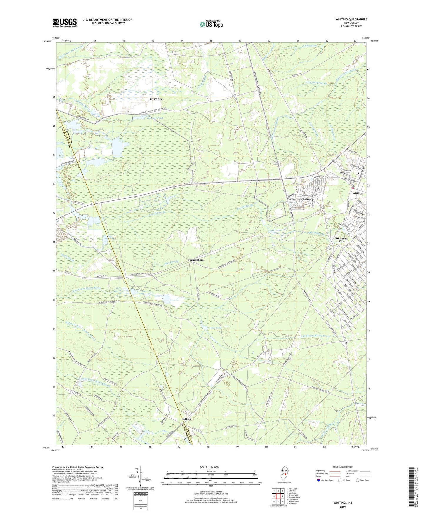
2019 topographic map quadrangle Whiting in the state of New Jersey. Scale: 1:24000. Based on the newly updated USGS 7.5' US Topo map series, this map is in the following counties: Ocean, Burlington. The map contains contour data, water features, and other items you are used to seeing on USGS maps, but also has updated roads and other features. This is the next generation of topographic maps. Printed on high-quality waterproof paper with UV fade-resistant inks.
Quads adjacent to this one:
West: Browns Mills
Northwest: New Egypt
North: Cassville
Northeast: Lakehurst
East: Keswick Grove
Southeast: Brookville
South: Woodmansie
Southwest: Chatsworth
Contains the following named places: Bay Shore Rod and Gun Club, Boyds Hotel, Buckingham, Bullock, Cedar Glen Lakes, Cedar Glen Lakes Census Designated Place, Deer Branch, Deer Park Branch, East Trenton Rod and Gun Club, Field and Stream Gunning Club, Forked Brook, Goodwater Branch, Goose Pond, Hanover Dam, Hanover Pond, Lebanon State Forest, Little Hurricane Branch, Manchester Wildlife Management Area, Pasadena Wildlife Management Area, Roosevelt City, Saint Johns Church, Webbs Mill, Wheatland, Whiting, Whiting Elementary School, Whiting Post Office, Whiting Volunteer Fire Company 1