MyTopo
Basin Well New Mexico US Topo Map
Couldn't load pickup availability
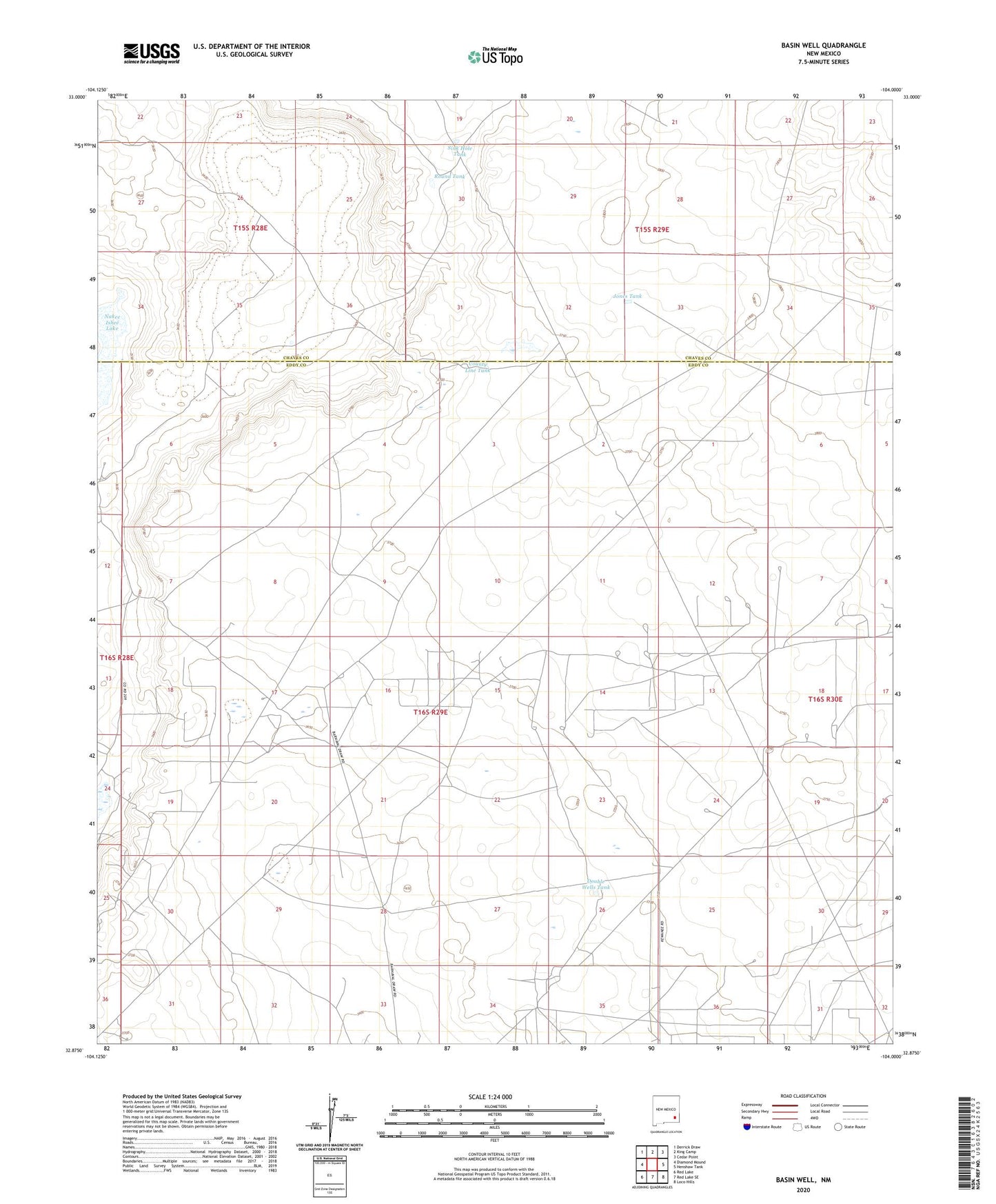
2020 topographic map quadrangle Basin Well in the state of New Mexico. Scale: 1:24000. Based on the newly updated USGS 7.5' US Topo map series, this map is in the following counties: Eddy, Chaves. The map contains contour data, water features, and other items you are used to seeing on USGS maps, but also has updated roads and other features. This is the next generation of topographic maps. Printed on high-quality waterproof paper with UV fade-resistant inks.
Quads adjacent to this one:
West: Diamond Mound
Northwest: Derrick Draw
North: King Camp
Northeast: Cedar Point
East: Henshaw Tank
Southeast: Loco Hills
South: Red Lake SE
Southwest: Red Lake
Contains the following named places: County Line Tank, Double Wells Tank, High Lonesome Windmill, Jones Tank, Nakee Ishee Lake, Round Tank, Sink Hole Tank