MyTopo
Derrick Draw New Mexico US Topo Map
Couldn't load pickup availability
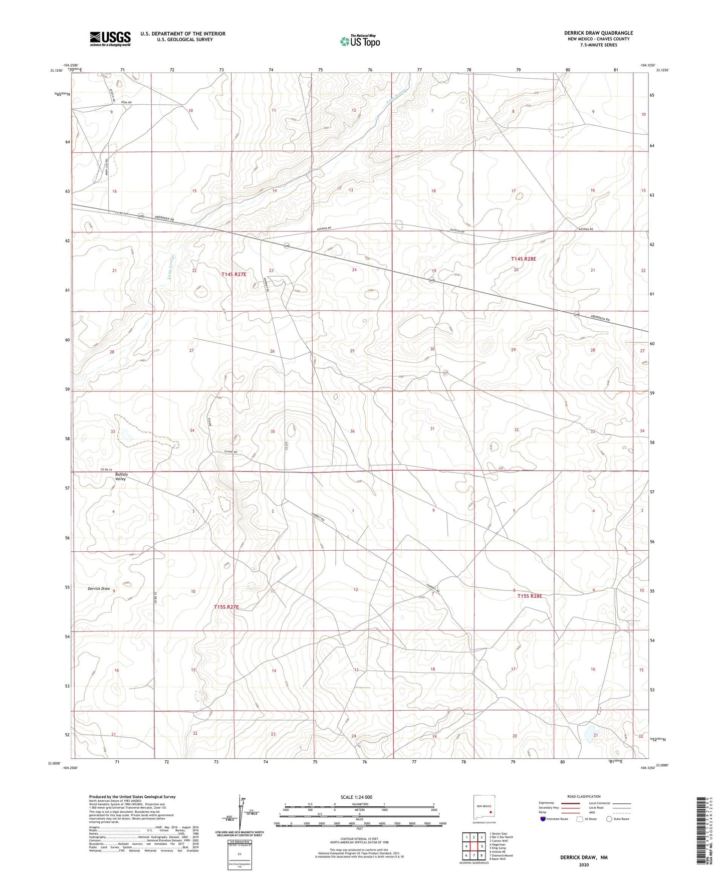
2023 topographic map quadrangle Derrick Draw in the state of New Mexico. Scale: 1:24000. Based on the newly updated USGS 7.5' US Topo map series, this map is in the following counties: Chaves. The map contains contour data, water features, and other items you are used to seeing on USGS maps, but also has updated roads and other features. This is the next generation of topographic maps. Printed on high-quality waterproof paper with UV fade-resistant inks.
Quads adjacent to this one:
West: Hagerman
Northwest: Dexter East
North: Bar C Bar Ranch
Northeast: Connor Well
East: King Camp
Southeast: Basin Well
South: Diamond Mound
Southwest: Artesia NE
This map covers the same area as the classic USGS quad with code o33104a2.
Contains the following named places: Calhoun Windmill, Cullins Windmill, Derrick Draw, Derrick Ranch, Greer Ranch, Hagerman Division, Haynes Windmill Historic Site, King Ranch, Rattlesnake Windmill, Walker Windmill