MyTopo
Cerro Hueco New Mexico US Topo Map
Couldn't load pickup availability
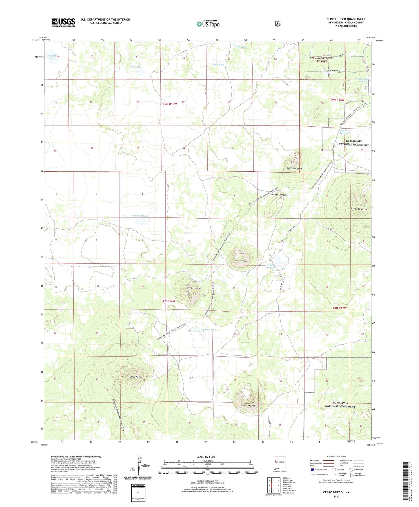
2020 topographic map quadrangle Cerro Hueco in the state of New Mexico. Scale: 1:24000. Based on the newly updated USGS 7.5' US Topo map series, this map is in the following counties: Cibola. The map contains contour data, water features, and other items you are used to seeing on USGS maps, but also has updated roads and other features. This is the next generation of topographic maps. Printed on high-quality waterproof paper with UV fade-resistant inks.
Quads adjacent to this one:
West: Goat Hill
Northwest: El Morro
North: Valle Largo
Northeast: Paxton Springs
East: Ice Caves
Southeast: Ice Caves SE
South: Cerro Brillante
Southwest: Cerro Alto
Contains the following named places: Big Lake, Boggy Lake, Cerrito Arizona, Cerrito Comadre, Cerro Americano, Cerro Hueco, Cerro Leonides, Cerro Negro, Cerro Rendija, Jacks Peak, Laguna Americana, Laguna Larga, Laguna Mason, Laguna Tarrito, Los Cerros Ranch, Mason Ranch, Twin Lakes, Williams Lake