MyTopo
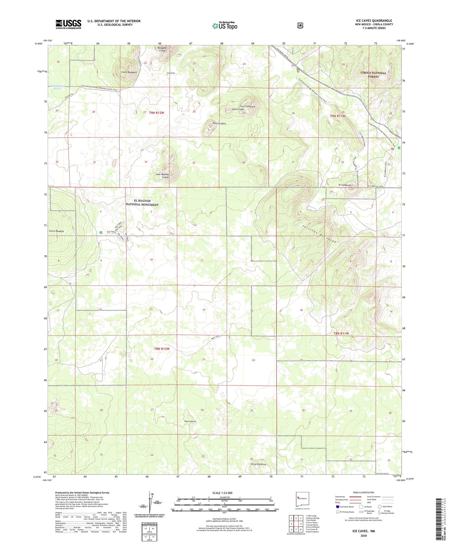
Ice Caves New Mexico US Topo Map
Couldn't load pickup availability
Also explore the Ice Caves Forest Service Topo of this same quad for updated USFS data
2023 topographic map quadrangle Ice Caves in the state of New Mexico. Scale: 1:24000. Based on the newly updated USGS 7.5' US Topo map series, this map is in the following counties: Cibola. The map contains contour data, water features, and other items you are used to seeing on USGS maps, but also has updated roads and other features. This is the next generation of topographic maps. Printed on high-quality waterproof paper with UV fade-resistant inks.
Quads adjacent to this one:
West: Cerro Hueco
Northwest: Valle Largo
North: Paxton Springs
Northeast: San Rafael
East: Arrosa Ranch
Southeast: North Pasture
South: Ice Caves SE
Southwest: Cerro Brillante
This map covers the same area as the classic USGS quad with code o34108h1.
Contains the following named places: Bandera Crater, Brights Water Well, Brights Well, Cerritos de Jaspe, Cerro Bandera, Cerro Candelaria, Cerro Encierro, El Calderon, Ice Caves, Laguna Juan Garcia, Lava Crater, Little Hole-In-The-Wall, Lost Woman Crater, Mesita Blanca, Prospector Deposit, Twin Craters