MyTopo
Columbus New Mexico US Topo Map
Couldn't load pickup availability
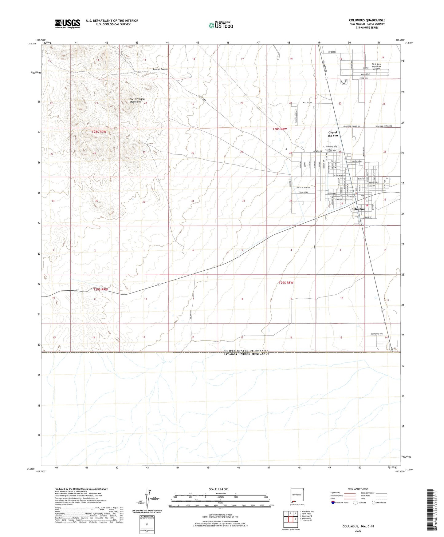
2020 topographic map quadrangle Columbus in the state of New Mexico. Scale: 1:24000. Based on the newly updated USGS 7.5' US Topo map series, this map is in the following counties: Luna. The map contains contour data, water features, and other items you are used to seeing on USGS maps, but also has updated roads and other features. This is the next generation of topographic maps. Printed on high-quality waterproof paper with UV fade-resistant inks.
Quads adjacent to this one:
West: Malpais Hill
Northwest: West Lime Hills
North: North Peak
Northeast: Columbus NE
East: Columbus SE
Contains the following named places: 01063 Water Well, 01069 Water Well, 01070 Water Well, 01106 Water Well, 01108 Water Well, 01109 Water Well, 01110 Water Well, 01111 Water Well, 01112 Water Well, 01113 Water Well, 01115 Water Well, 01116 Water Well, 01121 Water Well, 01122 Water Well, 01123 Water Well, 01644 Water Well, 06060 Water Well, 06061 Water Well, 06062 Water Well, 06117 Water Well, 06118 Water Well, 10412 Water Well, 10414 Water Well, 10415 Water Well, 10425 Water Well, 10426 Water Well, 1064 Water Well, 1646 Water Well, 88029, Border City, Camp Furlong Historic Site, Canon Mine, City of the Sun Census Designated Place, Columbus, Columbus Elementary School, Columbus Historical Museum, Columbus Municipal Airport, Columbus Police Department, Columbus Post Office, Columbus Stockyards Airport, Columbus Village Library, Columbus Volunteer Fire Department, Columbus Weather Station, First Aero Squadron Airpark, First Baptist Church, First Methodist Episcopal Church, Holy Family Parish Church, Lindberg, M-580 Water Well, Pancho Villa State Park, Pancho Villas Raid Historical Marker, Quarry, Rascon Canyon, Rascon Windmill, Valley Heights Cemetery, Village of Columbus