MyTopo
Columbus NE New Mexico US Topo Map
Couldn't load pickup availability
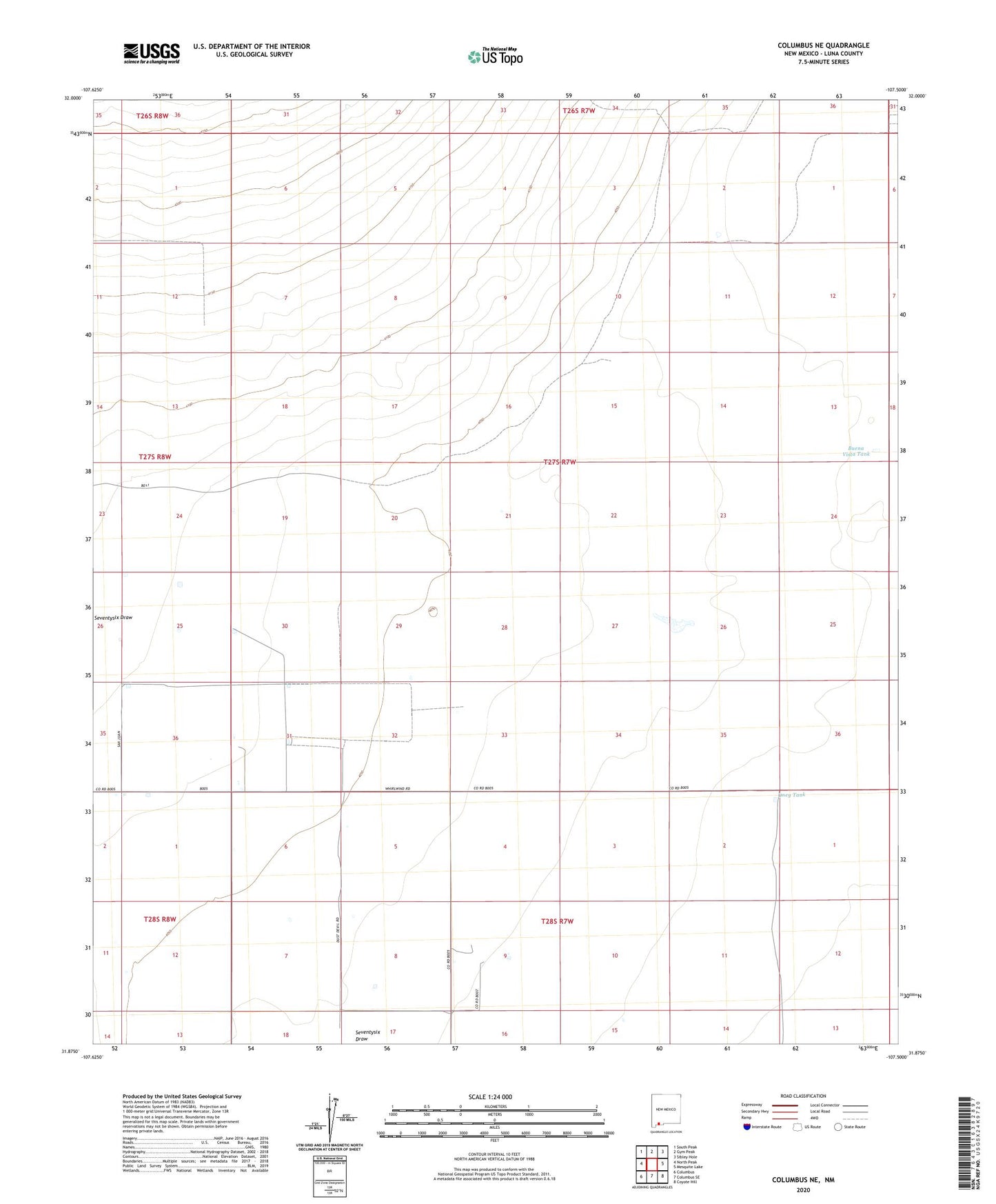
2023 topographic map quadrangle Columbus NE in the state of New Mexico. Scale: 1:24000. Based on the newly updated USGS 7.5' US Topo map series, this map is in the following counties: Luna. The map contains contour data, water features, and other items you are used to seeing on USGS maps, but also has updated roads and other features. This is the next generation of topographic maps. Printed on high-quality waterproof paper with UV fade-resistant inks.
Quads adjacent to this one:
West: North Peak
Northwest: South Peak
North: Gym Peak
Northeast: Sibley Hole
East: Mesquite Lake
Southeast: Coyote Hill
South: Columbus SE
Southwest: Columbus
This map covers the same area as the classic USGS quad with code o31107h5.
Contains the following named places: 00876 Water Well, 00878 Water Well, 00879 Water Well, 00880 Water Well, 00881 Water Well, 00883 Water Well, 00885 Water Well, 00886 Water Well, 00887 Water Well, 00888 Water Well, 00889 Water Well, 00890 Water Well, 00891 Water Well, 00919 Water Well, 00920 Water Well, 00921 Water Well, 00922 Water Well, 00927 Water Well, 00928 Water Well, 01028 Water Well, 01029 Water Well, 01030 Water Well, 01031 Water Well, 01032 Water Well, 01034 Water Well, 01049 Water Well, 06064 Water Well, 06116 Water Well, 10358 Water Well, 10359 Water Well, 10360 Water Well, 10374 Water Well, 10375 Water Well, 10389 Water Well, 10390 Water Well, 10404 Water Well, Buena Vista Tank, Coyote Windmill, M-812 Water Well, Oney Tank, Tucke Windmill, White King