MyTopo
Duoro New Mexico US Topo Map
Couldn't load pickup availability
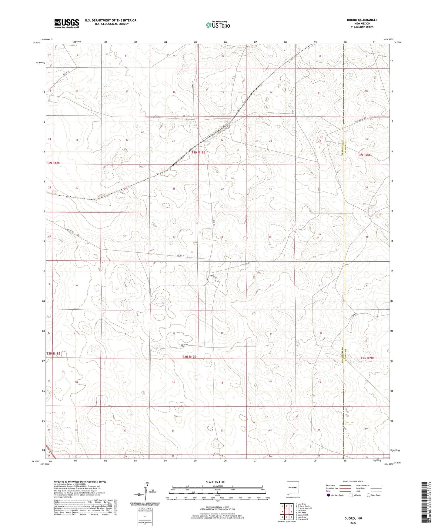
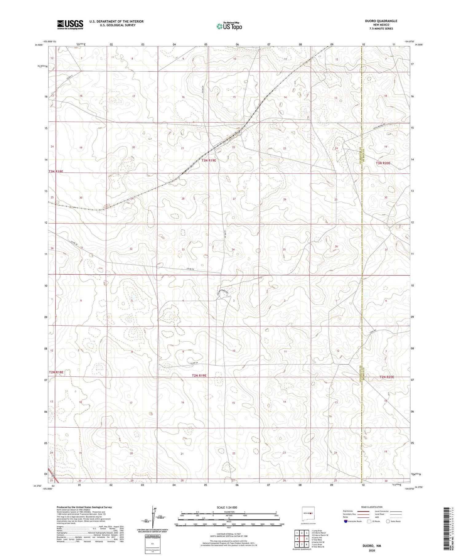
2020 topographic map quadrangle Duoro in the state of New Mexico. Scale: 1:24000. Based on the newly updated USGS 7.5' US Topo map series, this map is in the following counties: Guadalupe, De Baca. The map contains contour data, water features, and other items you are used to seeing on USGS maps, but also has updated roads and other features. This is the next generation of topographic maps. Printed on high-quality waterproof paper with UV fade-resistant inks.
Quads adjacent to this one:
West: Gacho Hill
Northwest: Long Draw
North: El Morro Ranch
Northeast: El Morro Ranch SE
East: Yeso Mesa
Southeast: Yeso Mesa SE
South: Loco Draw
Southwest: Gacho Hill SE
Contains the following named places: Antelope Well, Byrd Ranch, Duoro, Duoro Siding, Heifer Pature Well, Highway Well, Hunt Ranch, Loma Alta Well, Meadow Well, Rock Tank Well, Snell Well