MyTopo
Grady New Mexico US Topo Map
Couldn't load pickup availability
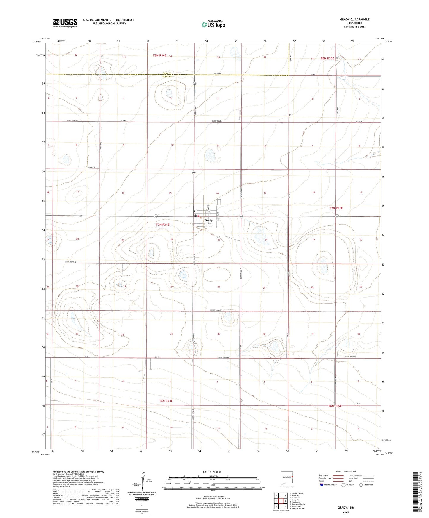
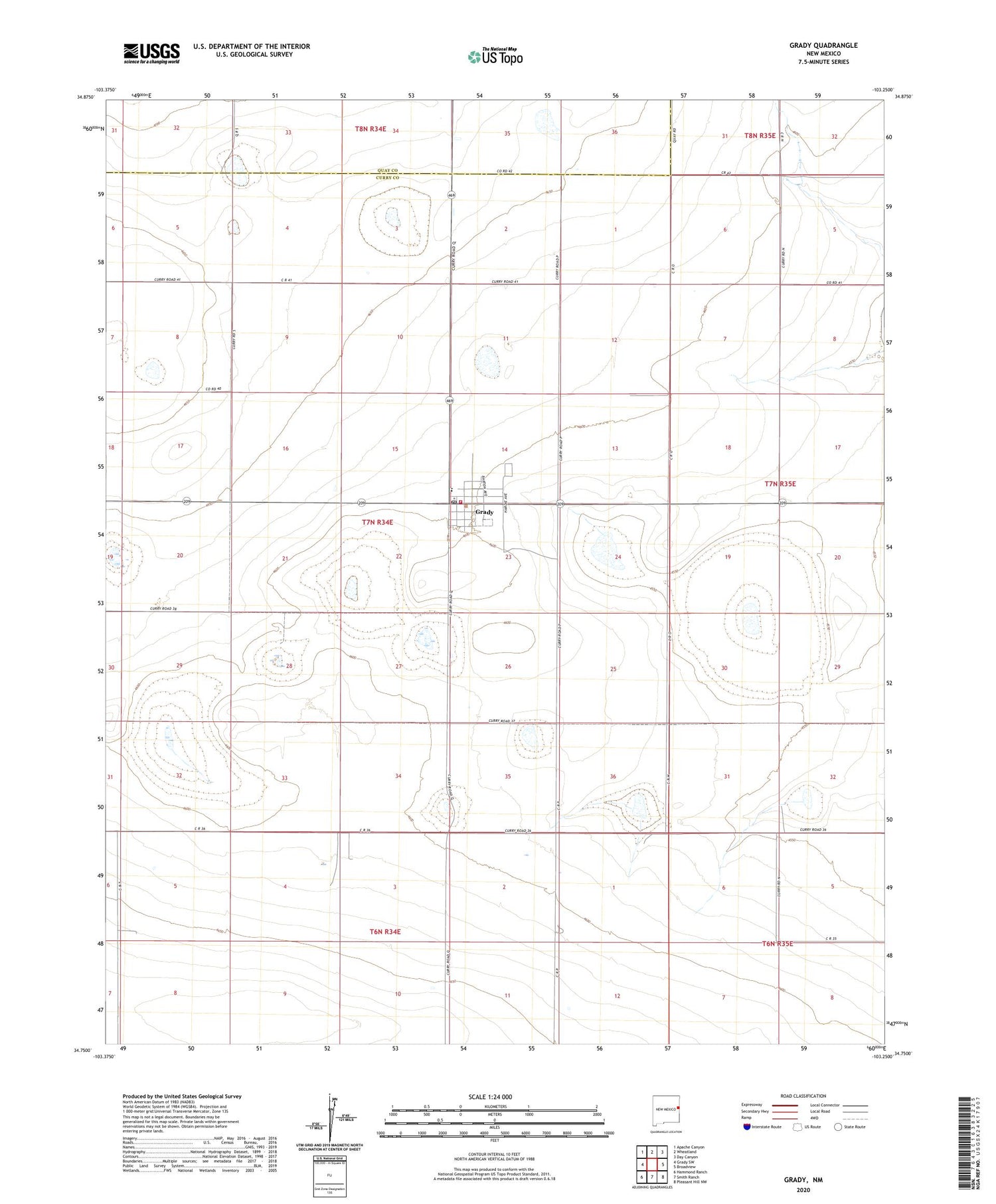
2020 topographic map quadrangle Grady in the state of New Mexico. Scale: 1:24000. Based on the newly updated USGS 7.5' US Topo map series, this map is in the following counties: Curry, Quay. The map contains contour data, water features, and other items you are used to seeing on USGS maps, but also has updated roads and other features. This is the next generation of topographic maps. Printed on high-quality waterproof paper with UV fade-resistant inks.
Quads adjacent to this one:
West: Grady SW
Northwest: Apache Canyon
North: Wheatland
Northeast: Day Canyon
East: Broadview
Southeast: Pleasant Hill NW
South: Smith Ranch
Southwest: Hammond Ranch
Contains the following named places: Delaney, Grady, Grady Baptist Church, Grady Cemetery, Grady Elementary School, Grady High School, Grady Post Office, Grady Volunteer Fire Department, Village of Grady, Ware, ZIP Code: 88120