MyTopo
Wheatland New Mexico US Topo Map
Couldn't load pickup availability
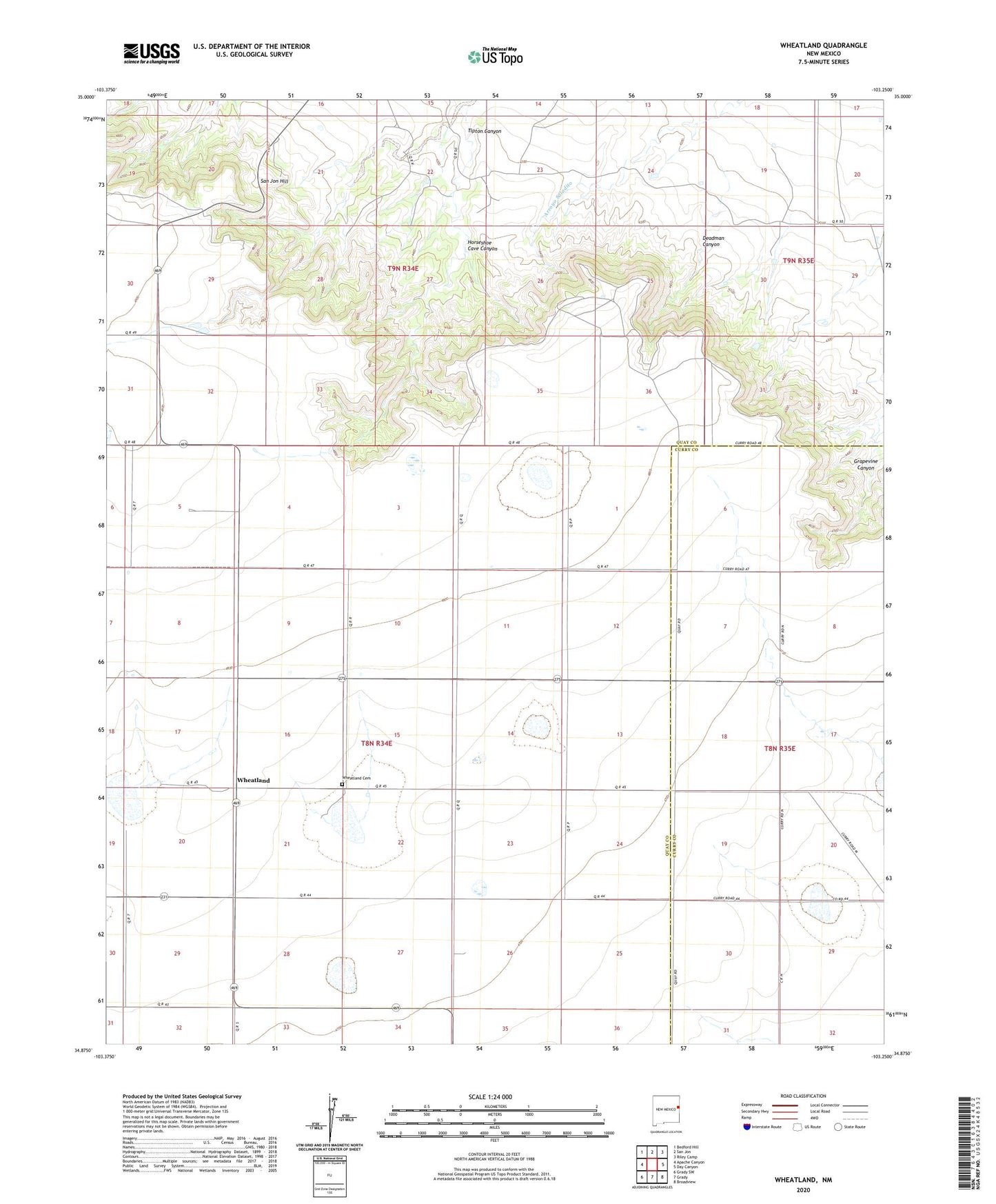
2023 topographic map quadrangle Wheatland in the state of New Mexico. Scale: 1:24000. Based on the newly updated USGS 7.5' US Topo map series, this map is in the following counties: Quay, Curry. The map contains contour data, water features, and other items you are used to seeing on USGS maps, but also has updated roads and other features. This is the next generation of topographic maps. Printed on high-quality waterproof paper with UV fade-resistant inks.
Quads adjacent to this one:
West: Apache Canyon
Northwest: Bedford Hill
North: San Jon
Northeast: Riley Camp
East: Day Canyon
Southeast: Broadview
South: Grady
Southwest: Grady SW
This map covers the same area as the classic USGS quad with code o34103h3.
Contains the following named places: Cameron Post Office, Cameron Weather Station, Deadman Canyon, Grapevine Canyon, Horseshoe Cave Canyon, Porter, San Jon Hill, Tipton Canyon, Wave, Wheatland, Wheatland Cemetery