MyTopo
Hillburn City New Mexico US Topo Map
Couldn't load pickup availability
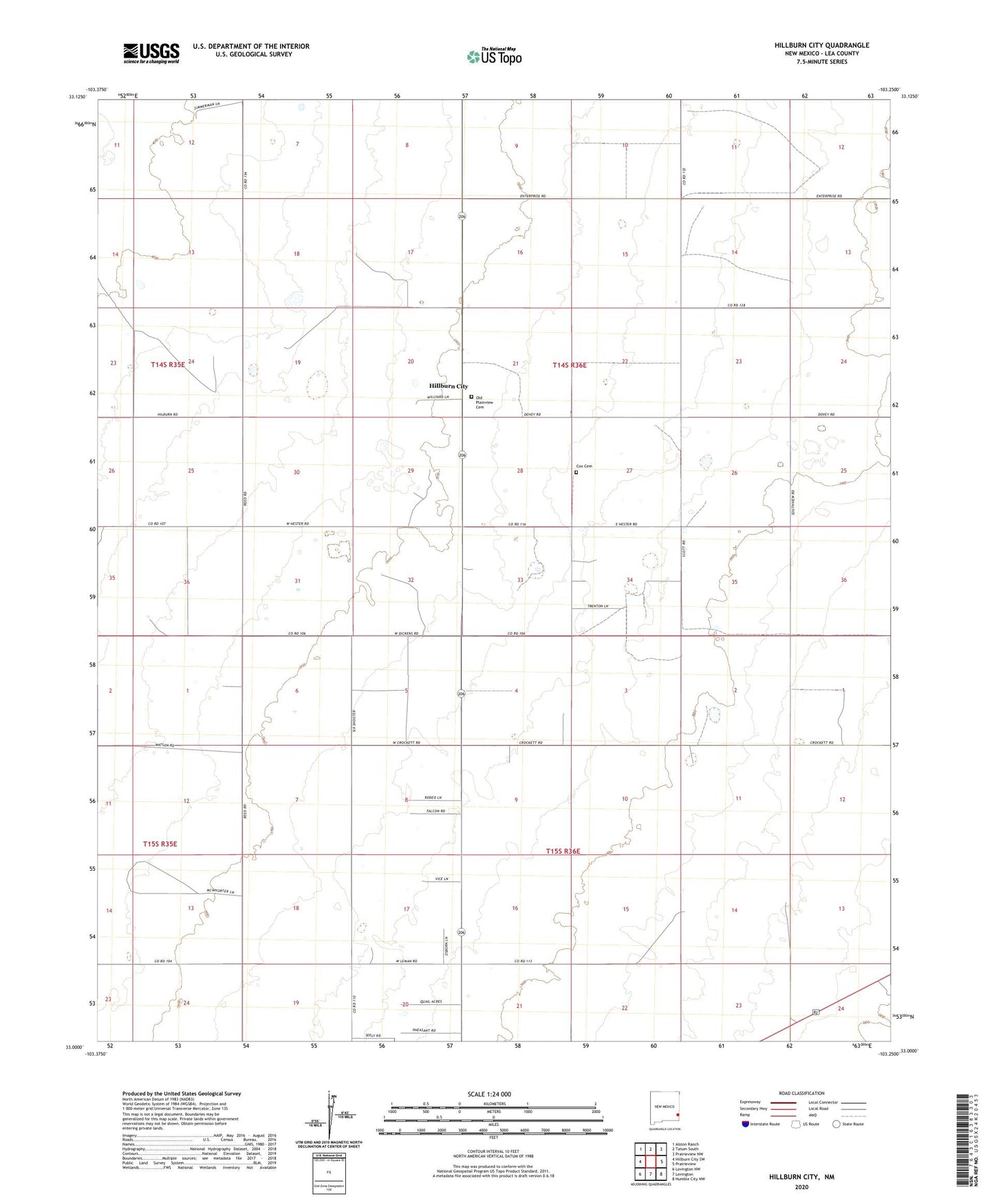
2020 topographic map quadrangle Hillburn City in the state of New Mexico. Scale: 1:24000. Based on the newly updated USGS 7.5' US Topo map series, this map is in the following counties: Lea. The map contains contour data, water features, and other items you are used to seeing on USGS maps, but also has updated roads and other features. This is the next generation of topographic maps. Printed on high-quality waterproof paper with UV fade-resistant inks.
Quads adjacent to this one:
West: Hillburn City SW
Northwest: Alston Ranch
North: Tatum South
Northeast: Prairieview NW
East: Prairieview
Southeast: Humble City NW
South: Lovington
Southwest: Lovington NW
Contains the following named places: 10060 Water Well, 10068 Water Well, 10071 Water Well, 10072 Water Well, 10073 Water Well, 10074 Water Well, 10075 Water Well, 10076 Water Well, 10077 Water Well, 10078 Water Well, 10115 Water Well, 10116 Water Well, 10118 Water Well, 10119 Water Well, 10120 Water Well, 10121 Water Well, 10122 Water Well, 10123 Water Well, 10124 Water Well, 10125 Water Well, 10126 Water Well, Caudill Oil Field, Cox Cemetery, Dean Windmill, Hillburn City, Old Plainview Cemetery