MyTopo
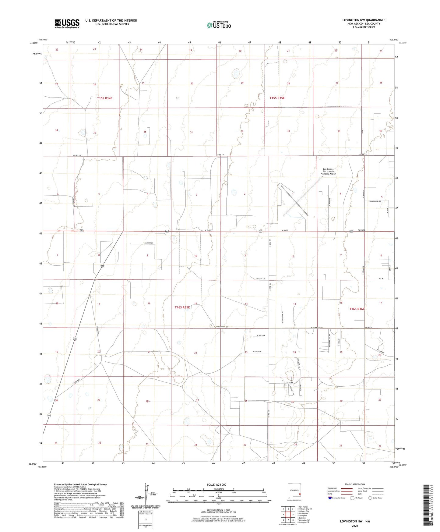
Lovington NW New Mexico US Topo Map
Couldn't load pickup availability
2023 topographic map quadrangle Lovington NW in the state of New Mexico. Scale: 1:24000. Based on the newly updated USGS 7.5' US Topo map series, this map is in the following counties: Lea. The map contains contour data, water features, and other items you are used to seeing on USGS maps, but also has updated roads and other features. This is the next generation of topographic maps. Printed on high-quality waterproof paper with UV fade-resistant inks.
Quads adjacent to this one:
West: Buckeye NE
Northwest: Fort Ranch
North: Hillburn City SW
Northeast: Hillburn City
East: Lovington
Southeast: Lovington SE
South: Lovington SW
Southwest: Buckeye
This map covers the same area as the classic USGS quad with code o32103h4.
Contains the following named places: Edson Ranch, Eidson Oil Field, Lea County-Zip Franklin Memorial Airport, Lovington Division, Mississippi Chem Corp Tailings Pond Dam, Shoe Bar Oil Field, Townsend Oil Field, ZIP Code: 88260