MyTopo
Horney Ranch New Mexico US Topo Map
Couldn't load pickup availability
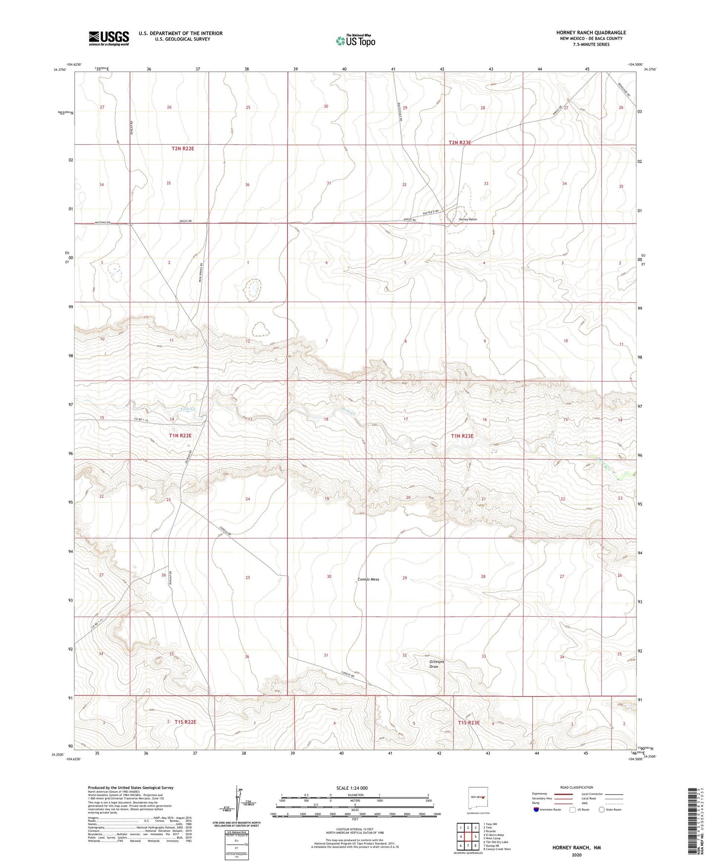
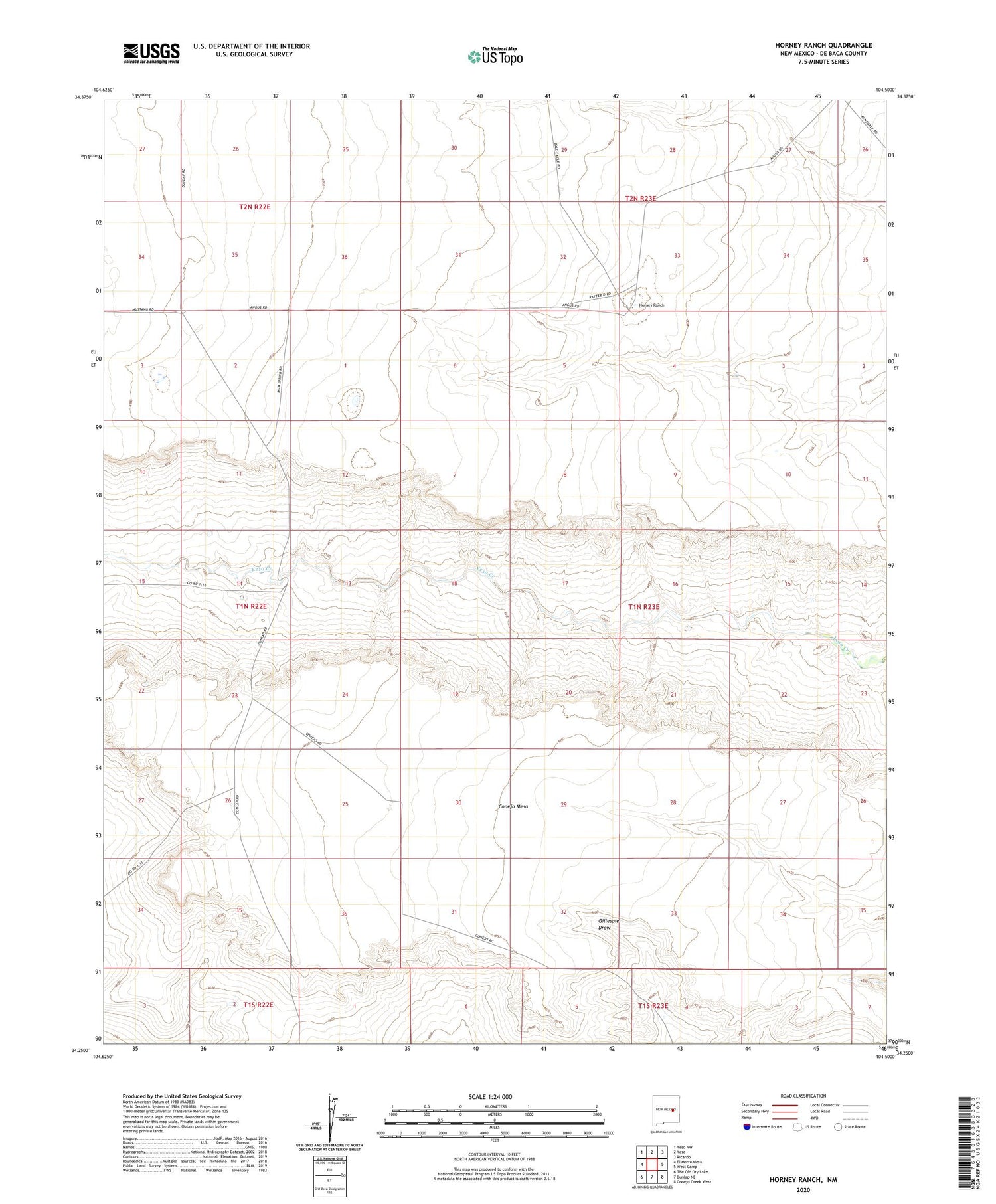
2020 topographic map quadrangle Horney Ranch in the state of New Mexico. Scale: 1:24000. Based on the newly updated USGS 7.5' US Topo map series, this map is in the following counties: De Baca. The map contains contour data, water features, and other items you are used to seeing on USGS maps, but also has updated roads and other features. This is the next generation of topographic maps. Printed on high-quality waterproof paper with UV fade-resistant inks.
Quads adjacent to this one:
West: El Morro Mesa
Northwest: Yeso NW
North: Yeso
Northeast: Ricardo
East: West Camp
Southeast: Conejo Creek West
South: Dunlap NE
Southwest: The Old Dry Lake
Contains the following named places: 10881 Water Well, Black Lake Windmill, Field Ranch, Horney Ranch, West De Baca Division, Yeso Camp Windmill