MyTopo
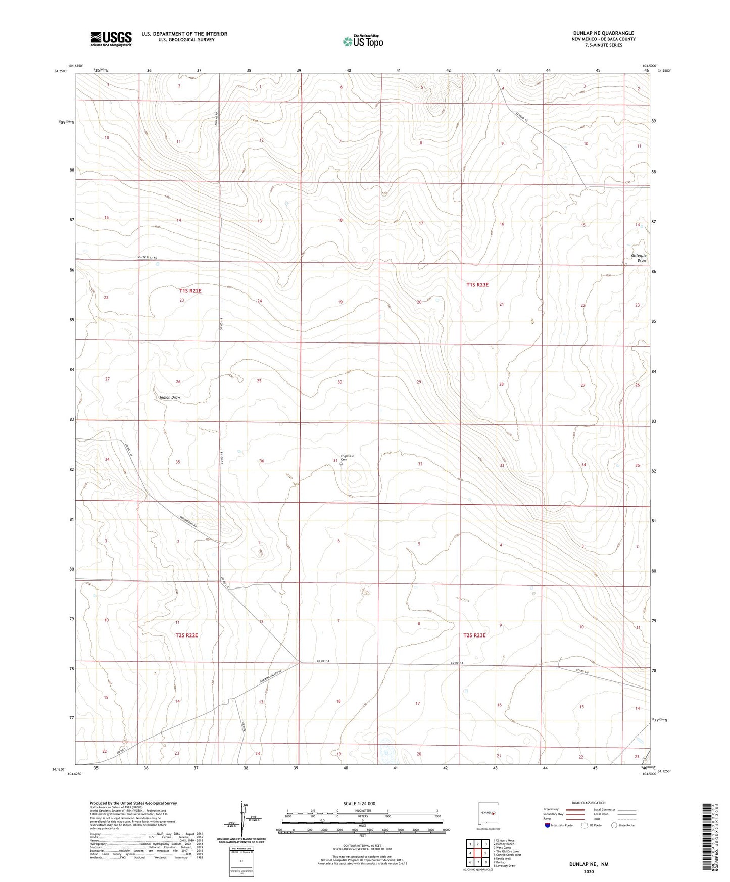
Dunlap NE New Mexico US Topo Map
Couldn't load pickup availability
2023 topographic map quadrangle Dunlap NE in the state of New Mexico. Scale: 1:24000. Based on the newly updated USGS 7.5' US Topo map series, this map is in the following counties: De Baca. The map contains contour data, water features, and other items you are used to seeing on USGS maps, but also has updated roads and other features. This is the next generation of topographic maps. Printed on high-quality waterproof paper with UV fade-resistant inks.
Quads adjacent to this one:
West: The Old Dry Lake
Northwest: El Morro Mesa
North: Horney Ranch
Northeast: West Camp
East: Conejo Creek West
Southeast: Lovelady Draw
South: Dunlap
Southwest: Devils Well
This map covers the same area as the classic USGS quad with code o34104b5.
Contains the following named places: Atwood Windmill, Cook Ranch, Cullen Windmill, Engleville Cemetery, First Presbyterian Church, First United Methodist Church, Hutchinson Windmill, Indian Draw, Key Ranch, Killo Windmill, Law Windmill, Lee Haney Windmill, McClure Windmill, North Markel Windmill, Northeast Windmill, Northwest Windmill, School Section Windmill, SoRelle Windmill, South Markel Windmill, South SoRelle Windmill, Stark Windmill, Steele Ranch, Thompson Windmill, Tom Haney Windmill, White Windmill, Windy Ridge Windmill