
MyTopo
House SE New Mexico US Topo Map
Couldn't load pickup availability
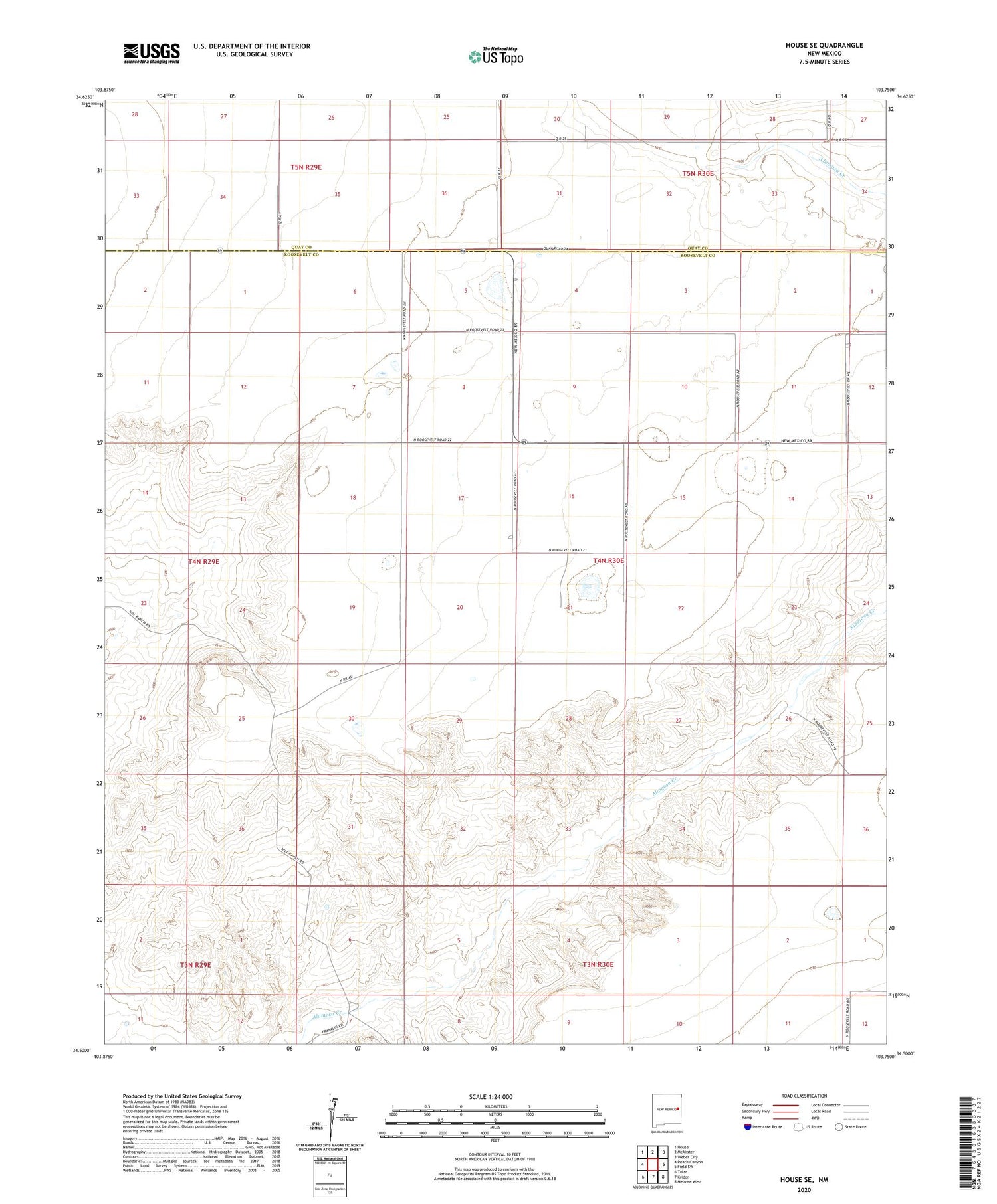
2020 topographic map quadrangle House SE in the state of New Mexico. Scale: 1:24000. Based on the newly updated USGS 7.5' US Topo map series, this map is in the following counties: Roosevelt, Quay. The map contains contour data, water features, and other items you are used to seeing on USGS maps, but also has updated roads and other features. This is the next generation of topographic maps. Printed on high-quality waterproof paper with UV fade-resistant inks.
Quads adjacent to this one:
West: Peach Canyon
Northwest: House
North: McAlister
Northeast: Weber City
East: Field SW
Southeast: Melrose West
South: Krider
Southwest: Tolar
Contains the following named places: 05036 Water Well, 05037 Water Well, 06029 Water Well, 06030 Water Well, 06031 Water Well, 06033 Water Well, 06034 Water Well, 06036 Water Well, 10298 Water Well, 10299 Water Well, 10302 Water Well, 10303 Water Well, 10306 Water Well, 10307 Water Well, 10308 Water Well, 10309 Water Well, 10310 Water Well, 10312 Water Well, 10313 Water Well, 10314 Water Well, 10315 Water Well, 10317 Water Well, 10319 Water Well, 10384 Water Well, 10385 Water Well, 10386 Water Well, 11689 Water Well, 12246 Water Well, 12248 Water Well, 12249 Water Well, 12250 Water Well, 12501 Water Well, 12708 Water Well, Ferguson, Smith


