MyTopo
Field SW New Mexico US Topo Map
Couldn't load pickup availability
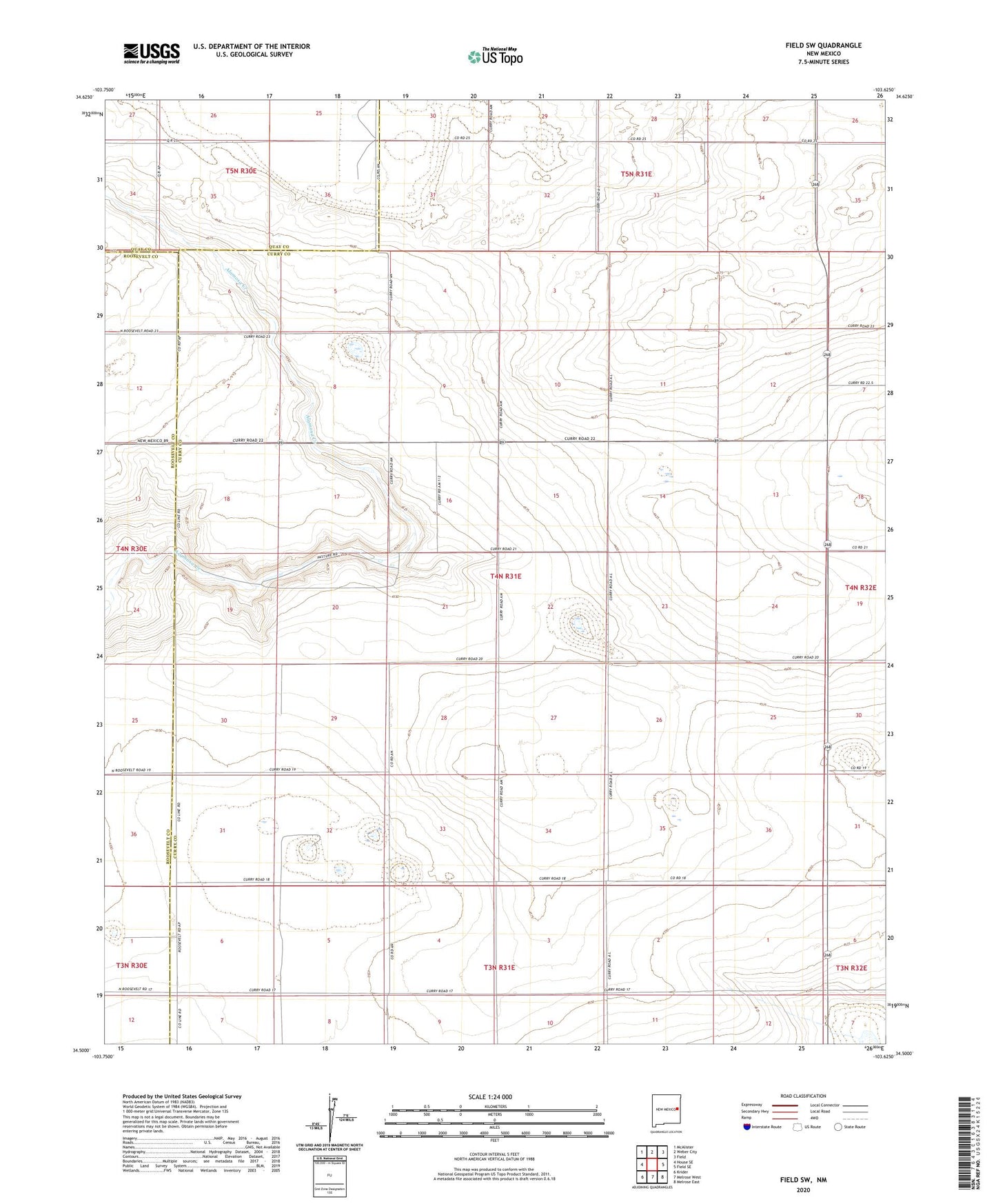
2023 topographic map quadrangle Field SW in the state of New Mexico. Scale: 1:24000. Based on the newly updated USGS 7.5' US Topo map series, this map is in the following counties: Curry, Roosevelt, Quay. The map contains contour data, water features, and other items you are used to seeing on USGS maps, but also has updated roads and other features. This is the next generation of topographic maps. Printed on high-quality waterproof paper with UV fade-resistant inks.
Quads adjacent to this one:
West: House SE
Northwest: McAlister
North: Weber City
Northeast: Field
East: Field SE
Southeast: Melrose East
South: Melrose West
Southwest: Krider
This map covers the same area as the classic USGS quad with code o34103e6.
Contains the following named places: 05033 Water Well, 06035 Water Well, 06037 Water Well, 10304 Water Well, 10305 Water Well, 10306 Water Well, 10307 Water Well, 10308 Water Well, 10311 Water Well, 10312 Water Well, 10316 Water Well, 10693 Water Well, 10724 Water Well, 10783 Water Well, 12247 Water Well, 88124