MyTopo
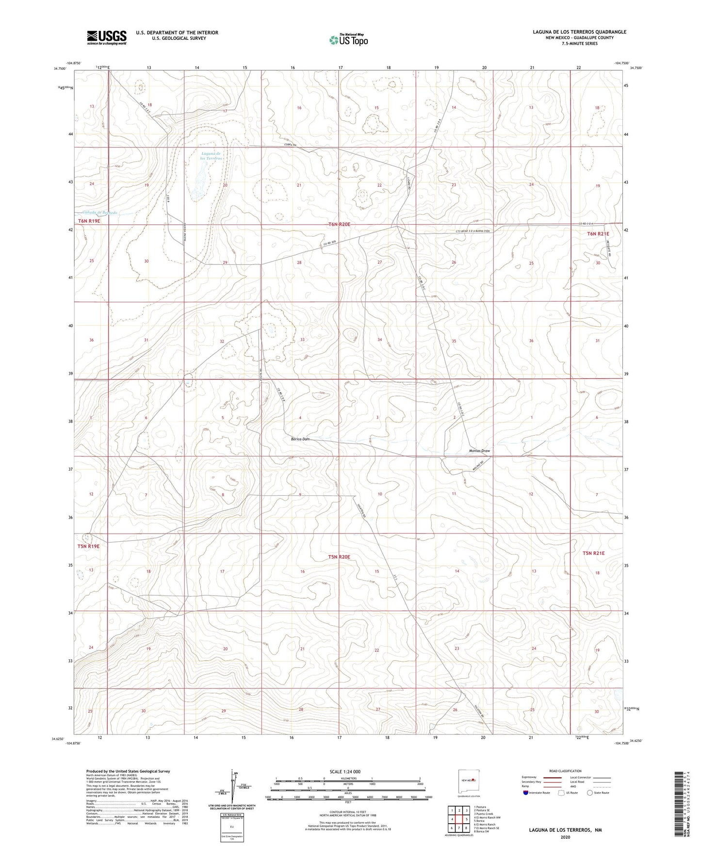
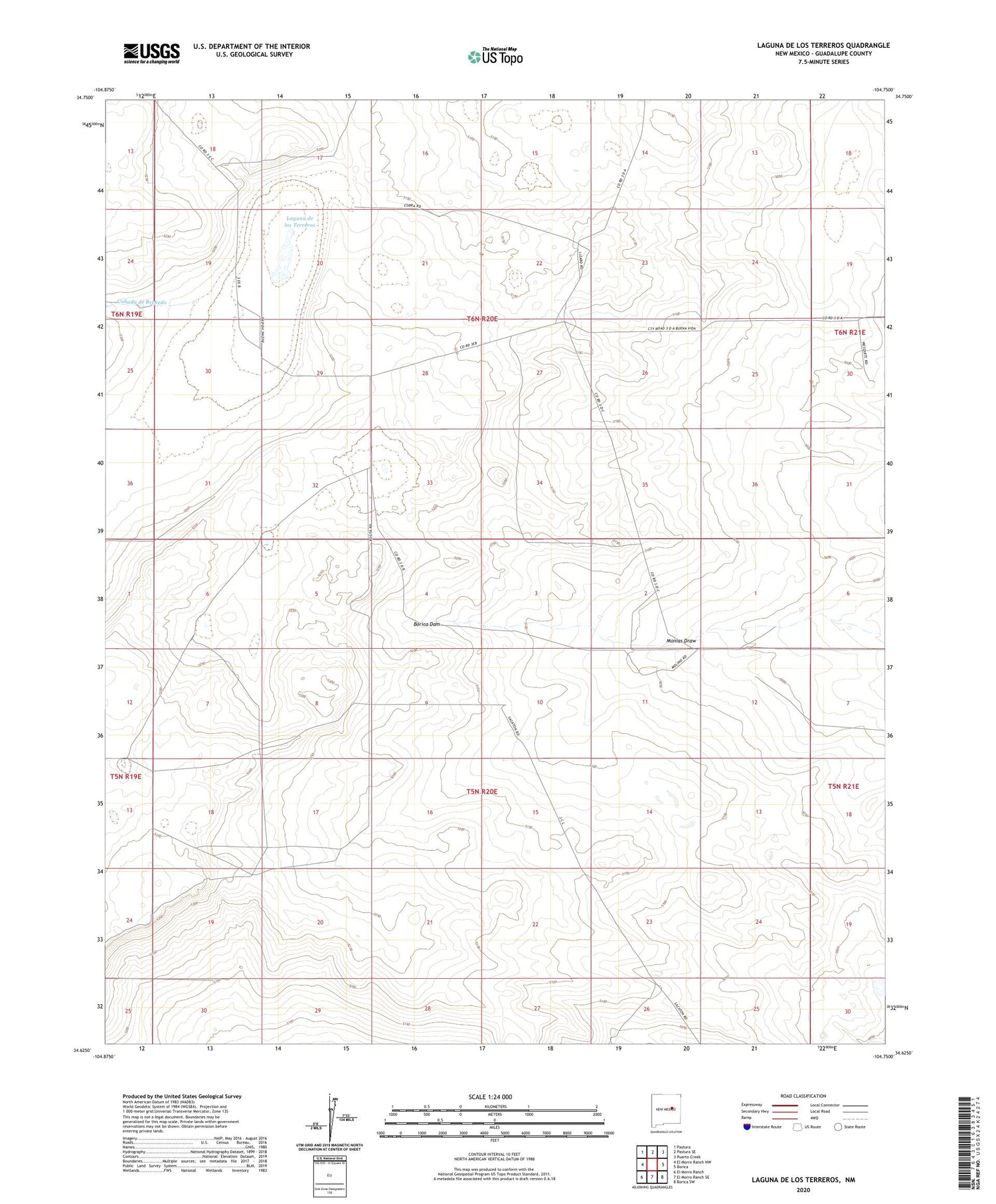
Laguna De Los Terreros New Mexico US Topo Map
Couldn't load pickup availability
2020 topographic map quadrangle Laguna De Los Terreros in the state of New Mexico. Scale: 1:24000. Based on the newly updated USGS 7.5' US Topo map series, this map is in the following counties: Guadalupe. The map contains contour data, water features, and other items you are used to seeing on USGS maps, but also has updated roads and other features. This is the next generation of topographic maps. Printed on high-quality waterproof paper with UV fade-resistant inks.
Quads adjacent to this one:
West: El Morro Ranch NW
Northwest: Pastura
North: Pastura SE
Northeast: Puerto Creek
East: Borica
Southeast: Borica SW
South: El Morro Ranch SE
Southwest: El Morro Ranch
Contains the following named places: Bull Pasture Windmill, Canada de Brehedo, Gardner Windmill, High Lonesome Windmill, Johnson Ranch, Laguna de los Terreros, Little Muniz Windmill, Monias Draw, Monias Windmill, Muniz Ranch, New Monias Windmill, Ortega Ranch, Romero Ranch, South Windmill