MyTopo
Loma Machete New Mexico US Topo Map
Couldn't load pickup availability
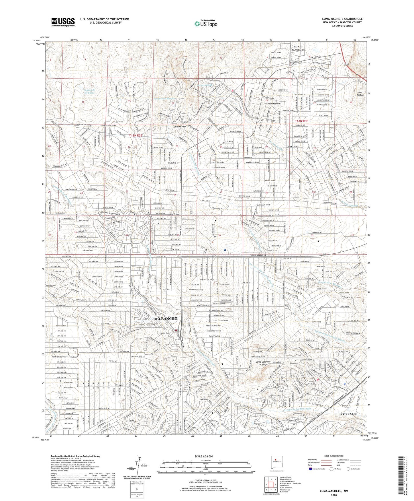
2020 topographic map quadrangle Loma Machete in the state of New Mexico. Scale: 1:24000. Based on the newly updated USGS 7.5' US Topo map series, this map is in the following counties: Sandoval. The map contains contour data, water features, and other items you are used to seeing on USGS maps, but also has updated roads and other features. This is the next generation of topographic maps. Printed on high-quality waterproof paper with UV fade-resistant inks.
Quads adjacent to this one:
West: Arroyo de las Calabacillas
Northwest: Cerro Conejo
North: Bernalillo NW
Northeast: Santa Ana Pueblo
East: Bernalillo
Southeast: Alameda
South: Los Griegos
Southwest: The Volcanoes
Contains the following named places: Arroyo Pantadeleon, City of Rio Rancho, Enchanted Hills Elementary School, Laguna de las Bacas, Leon Grande Park, Loma Barbon, Loma Colorado de Abajo, Loma Duran, Loma Machete, Picuda Peak, Presbyterian Medical Group Outpatient Clinic, Prices Dairy Airport, Rio Rancho Fire and Rescue Station 2, Rio Rancho Fire and Rescue Station Number 7, Rio Rancho Police Department, University of New Mexico Sandoval Regional Medical Center, Veja Baja Park, Vista Hills Park, ZIP Code: 87144