MyTopo
Malpais Hill New Mexico US Topo Map
Couldn't load pickup availability
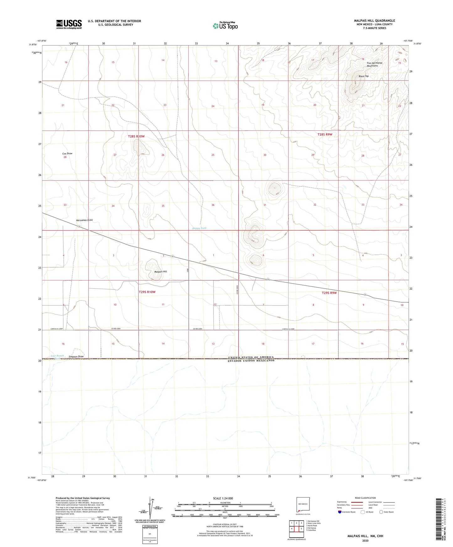
2020 topographic map quadrangle Malpais Hill in the state of New Mexico. Scale: 1:24000. Based on the newly updated USGS 7.5' US Topo map series, this map is in the following counties: Luna. The map contains contour data, water features, and other items you are used to seeing on USGS maps, but also has updated roads and other features. This is the next generation of topographic maps. Printed on high-quality waterproof paper with UV fade-resistant inks.
Quads adjacent to this one:
West: Hermanas
Northwest: Hermanas NW
North: West Lime Hills
Northeast: North Peak
East: Columbus
Contains the following named places: 001161 Water Well, 01077 Water Well, 01124 Water Well, 01126 Water Well, 01127 Water Well, 01129 Water Well, 01130 Water Well, 01134 Water Well, 01136 Water Well, 01141 Water Well, 01149 Water Well, 01150 Water Well, 01151 Water Well, 01153 Water Well, 01154 Water Well, 01155 Water Well, 01157 Water Well, 01159 Water Well, 01162 Water Well, 01650 Water Well, 01657 Water Well, 01658 Water Well, 06126 Water Well, 06127 Water Well, 06157 Water Well, 10429 Water Well, 10430 Water Well, 10431 Water Well, 10432 Water Well, 10433 Water Well, 10437 Water Well, 10438 Water Well, 10439 Water Well, 10440 Water Well, 10441 Water Well, 1078 Water Well, Black Top, Cox Draw, Dogtown Ranch, Edwards Ranch, Hermanas Draw, Hoppy Tank, Line Ranch Tank, M-3928 Water Well, Malpais Hill, Mimbres, Simpson Draw, Simpson Well