MyTopo
Hermanas NW New Mexico US Topo Map
Couldn't load pickup availability
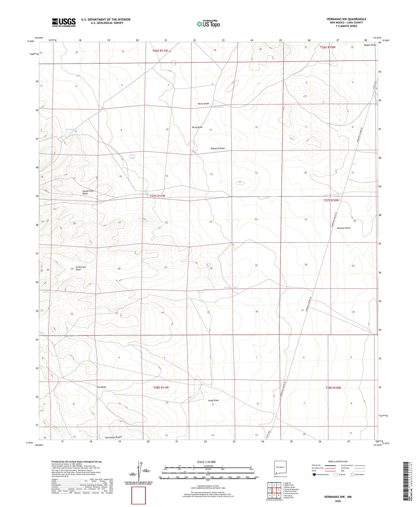
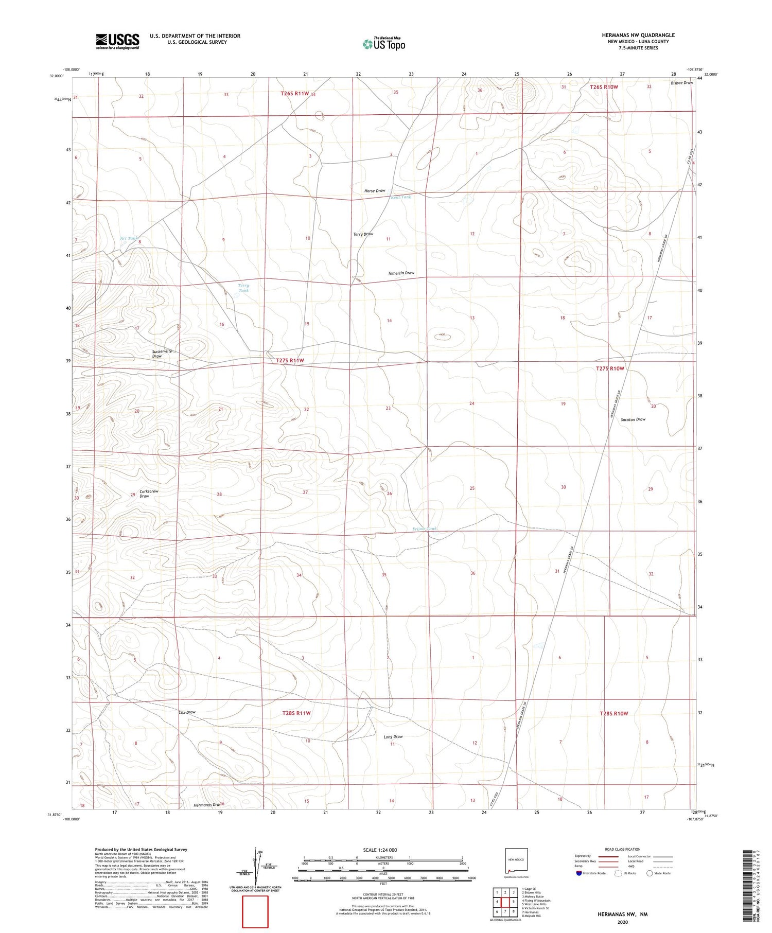
2023 topographic map quadrangle Hermanas NW in the state of New Mexico. Scale: 1:24000. Based on the newly updated USGS 7.5' US Topo map series, this map is in the following counties: Luna. The map contains contour data, water features, and other items you are used to seeing on USGS maps, but also has updated roads and other features. This is the next generation of topographic maps. Printed on high-quality waterproof paper with UV fade-resistant inks.
Quads adjacent to this one:
West: Flying W Mountain
Northwest: Gage SE
North: Bisbee Hills
Northeast: Midway Butte
East: West Lime Hills
Southeast: Malpais Hill
South: Hermanas
Southwest: Victorio Ranch SE
This map covers the same area as the classic USGS quad with code o31107h8.
Contains the following named places: 01074 Water Well, 01079 Water Well, 01081 Water Well, 01636 Water Well, 0166 Water Well, 01668 Water Well, Art Tank, Corkscrew Draw, Cox Ranch, Frijole Tank, Horse Draw, Kent Tank, Long Draw, Midway Windmill, Miller Windmill, Miller-Gibson Dam Number 3, Miller-Gibson Dam Number 4, Ruckman Windmill, Sacaton Draw, Sacaton Windmill, Terry Draw, Terry Tank, Terry Windmill