MyTopo
Martin Draw New Mexico US Topo Map
Couldn't load pickup availability
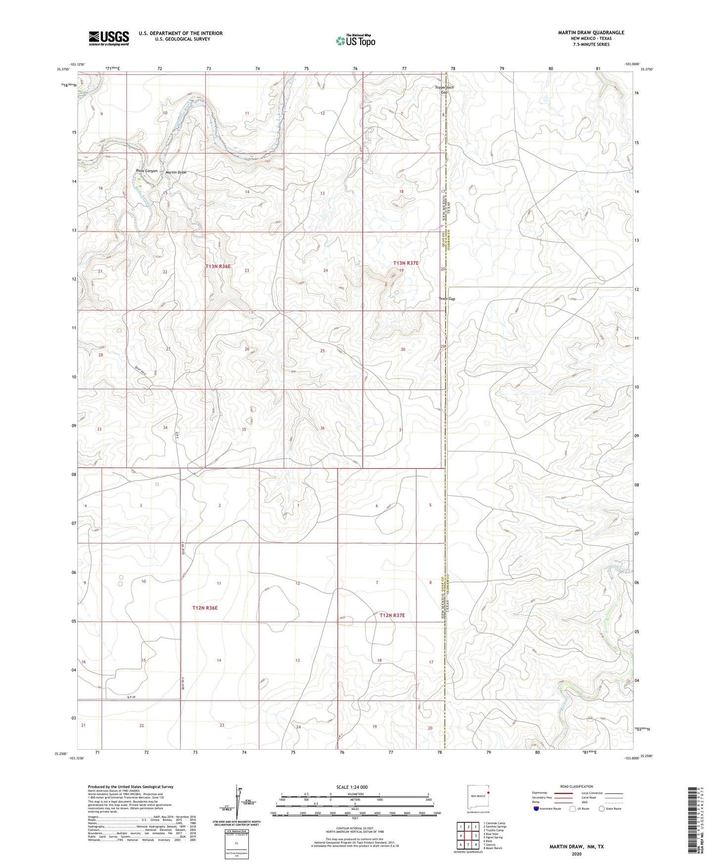
2020 topographic map quadrangle Martin Draw in the states of New Mexico, Texas. Scale: 1:24000. Based on the newly updated USGS 7.5' US Topo map series, this map is in the following counties: Quay, Oldham. The map contains contour data, water features, and other items you are used to seeing on USGS maps, but also has updated roads and other features. This is the next generation of topographic maps. Printed on high-quality waterproof paper with UV fade-resistant inks.
Quads adjacent to this one:
West: Blue Hole
Northwest: Cammak Camp
Northeast: Trujillo Camp
East: Signal Spring
Southeast: Moser Ranch
South: Glenrio
Southwest: Bard
Contains the following named places: 05424 Water Well, 05425 Water Well, 05429 Water Well, 05430 Water Well, 05431 Water Well, 05432 Water Well, 05524 Water Well, 05526 Water Well, 05530 Water Well, 05531 Water Well, Bethe Windmill, Buffalo Windmill, Division Well, Howdy Ranch, Martin Draw, Middle Well, Rain Place, Rana Arroyo, Rana Canyon, Rats Windmill, River Windmill, Ship Windmill, Sissy Windmill, Smithers Windmill, Snake Windmill, Southwest Well, Stagecoach Gap, Texas Gap, Trujillo Creek