MyTopo
Mesa Draw New Mexico US Topo Map
Couldn't load pickup availability
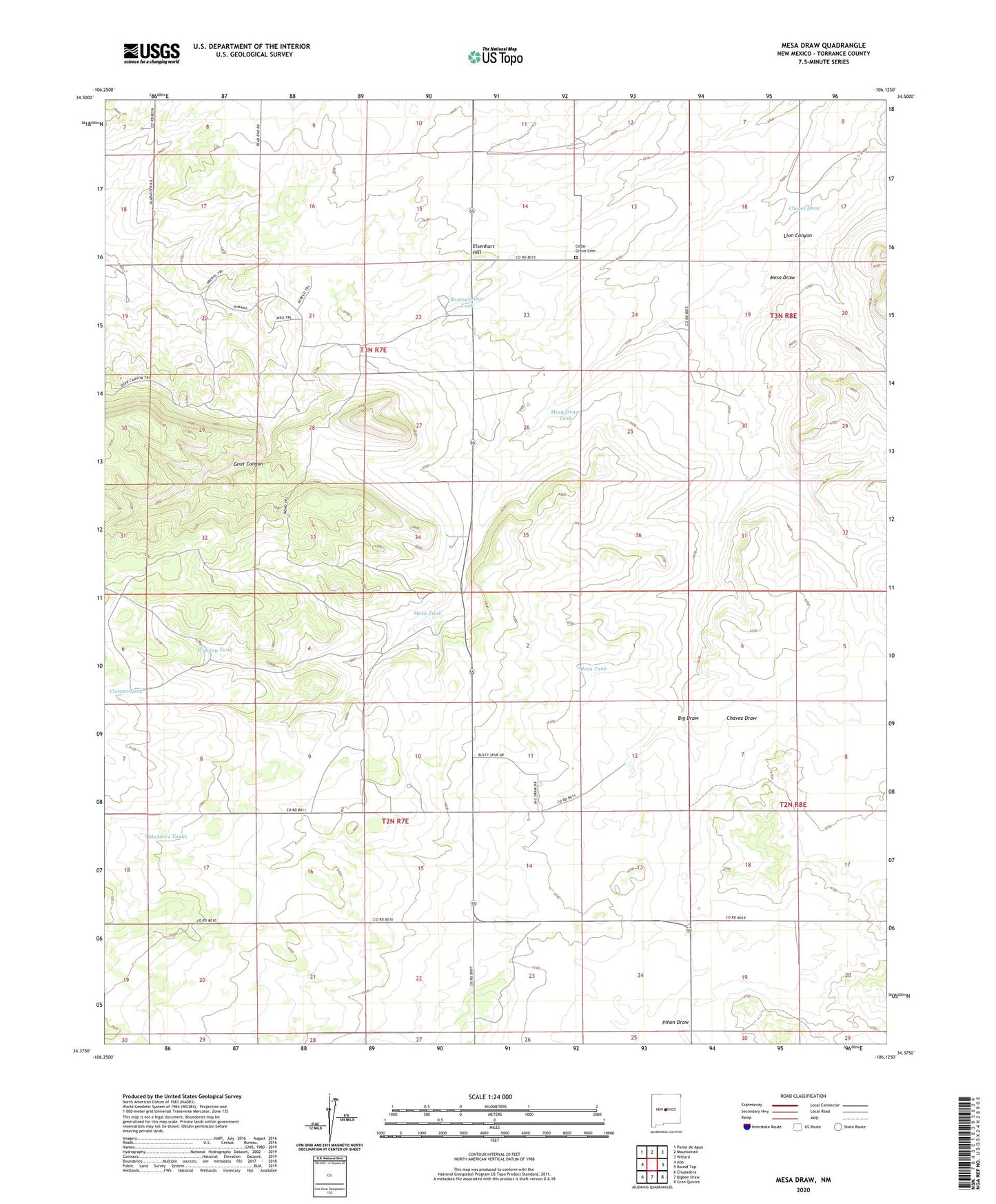
2020 topographic map quadrangle Mesa Draw in the state of New Mexico. Scale: 1:24000. Based on the newly updated USGS 7.5' US Topo map series, this map is in the following counties: Torrance. The map contains contour data, water features, and other items you are used to seeing on USGS maps, but also has updated roads and other features. This is the next generation of topographic maps. Printed on high-quality waterproof paper with UV fade-resistant inks.
Quads adjacent to this one:
West: Abo
Northwest: Punta de Agua
North: Mountainair
Northeast: Willard
East: Round Top
Southeast: Gran Quivira
South: Bigbee Draw
Southwest: Chupadera
Contains the following named places: Baumgartner Tank, Big Draw, Cedar Grove Cemetery, Chaves Draw, Cistern Tank, Eisenhart Hill, Everhart Well, Goat Canyon Well, Lion Canyon, Medders Tanks, Mesa Draw, Mesa Draw Tank, Mesa Tank, Midway Tank, North Well, Pinon Draw, Shaw Well, Viejo Well, ZIP Code: 87036