MyTopo
Chupadera New Mexico US Topo Map
Couldn't load pickup availability
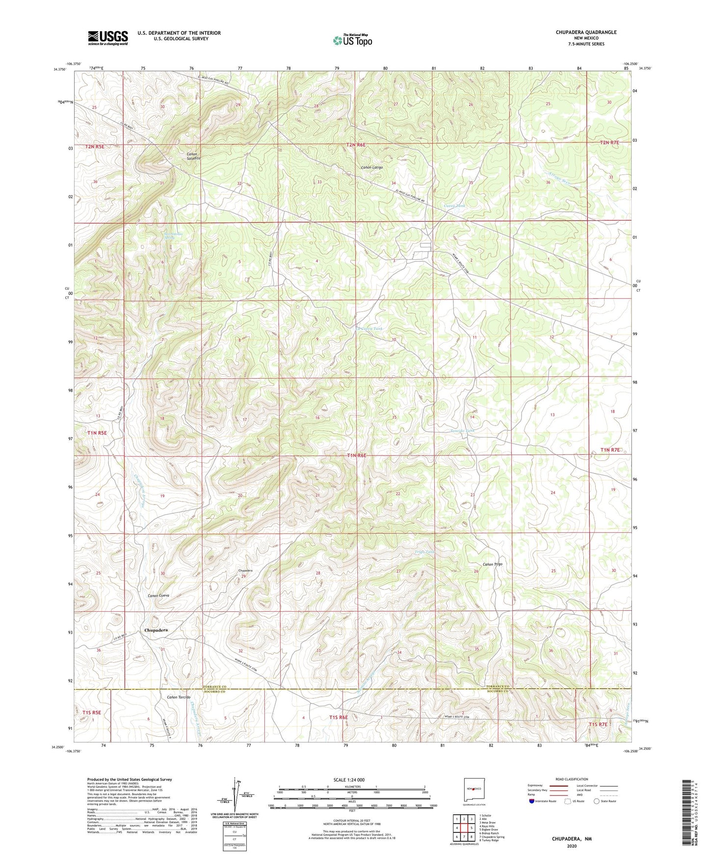
2023 topographic map quadrangle Chupadera in the state of New Mexico. Scale: 1:24000. Based on the newly updated USGS 7.5' US Topo map series, this map is in the following counties: Torrance, Socorro. The map contains contour data, water features, and other items you are used to seeing on USGS maps, but also has updated roads and other features. This is the next generation of topographic maps. Printed on high-quality waterproof paper with UV fade-resistant inks.
Quads adjacent to this one:
West: Rayo Hills
Northwest: Scholle
North: Abo
Northeast: Mesa Draw
East: Bigbee Draw
Southeast: Turkey Ridge
South: Chupadera Spring
Southwest: Bishop Ranch
This map covers the same area as the classic USGS quad with code o34106c3.
Contains the following named places: Adams Iron Pit, Canon Cueva, Canon Torcido, Chupadera, Chupadera Windmill, Cueva Tank, Estancia I Crawford Mine, Fite Mine, Geoslim Pit, La Cueva Tank, Mountainair Pumping Station, San Antonio Spring, Torcido Tank, Transwestern Pipeline Number 7 Airport, Trigo Tank