
MyTopo
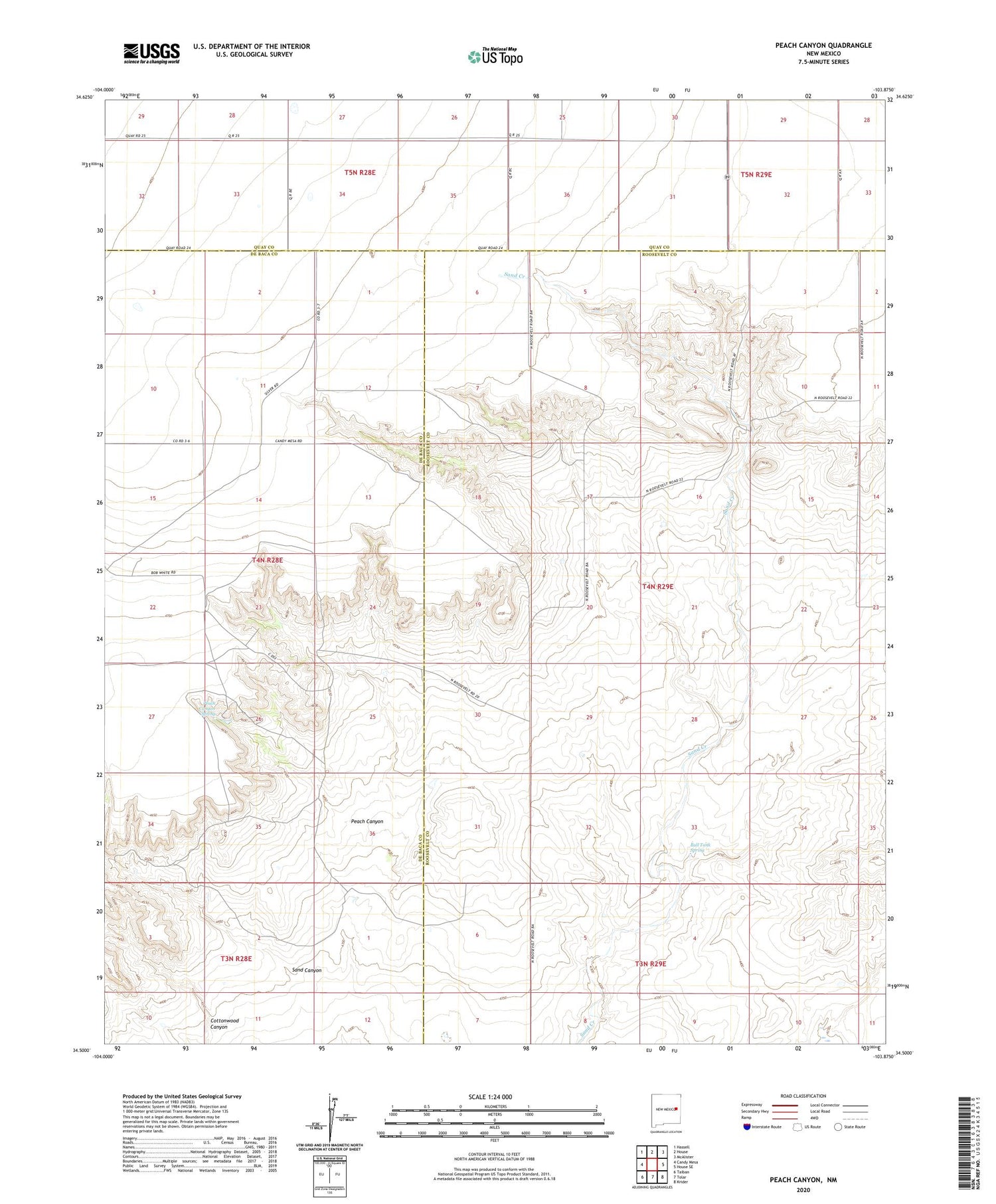
Peach Canyon New Mexico US Topo Map
Couldn't load pickup availability
2020 topographic map quadrangle Peach Canyon in the state of New Mexico. Scale: 1:24000. Based on the newly updated USGS 7.5' US Topo map series, this map is in the following counties: Roosevelt, De Baca, Quay. The map contains contour data, water features, and other items you are used to seeing on USGS maps, but also has updated roads and other features. This is the next generation of topographic maps. Printed on high-quality waterproof paper with UV fade-resistant inks.
Quads adjacent to this one:
West: Candy Mesa
Northwest: Hassell
North: House
Northeast: McAlister
East: House SE
Southeast: Krider
South: Tolar
Southwest: Taiban
Contains the following named places: 06032 Water Well, 06038 Water Well, 06039 Water Well, 06040 Water Well, 06041 Water Well, 10209 Water Well, 10237 Water Well, 10238 Water Well, 10242 Water Well, 10243 Water Well, 10244 Water Well, 10245 Water Well, 10246 Water Well, 10247 Water Well, 10248 Water Well, 10297 Water Well, 10300 Water Well, 10301 Water Well, 10339 Water Well, 10342 Water Well, 10343 Water Well, 10344 Water Well, 10555 Water Well, 10556 Water Well, 10559 WAter Well, 10560 Water Well, 10561 Water Well, 10562 Water Well, 10568 Water Well, 10569 Water Well, 10623 Water Well, 10624 Water Well, 10625 Water Well, 10626 Water Well, 10653 Water Well, 10718 Water Well, 11693 Water Well, 11694 Water Well, 11695 Water Well, 12251 Water Well, 12252 Water Well, 12500 Water Well, Bull Tank Spring, Cottonwood Canyon, Peach Canyon, Peach Canyon Spring, Sand Canyon


