MyTopo
Candy Mesa New Mexico US Topo Map
Couldn't load pickup availability
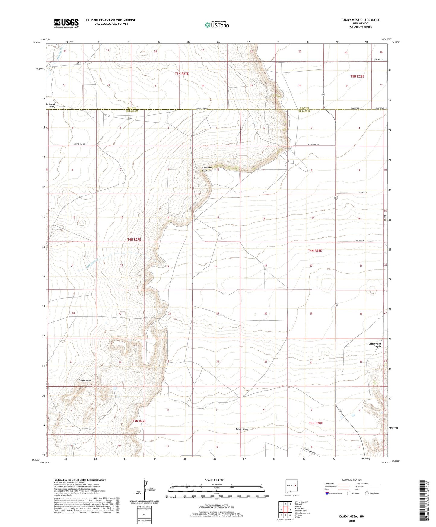
2023 topographic map quadrangle Candy Mesa in the state of New Mexico. Scale: 1:24000. Based on the newly updated USGS 7.5' US Topo map series, this map is in the following counties: De Baca, Quay. The map contains contour data, water features, and other items you are used to seeing on USGS maps, but also has updated roads and other features. This is the next generation of topographic maps. Printed on high-quality waterproof paper with UV fade-resistant inks.
Quads adjacent to this one:
West: Twin Mesa
Northwest: Twin Mesa NW
North: Hassell
Northeast: House
East: Peach Canyon
Southeast: Tolar
South: Taiban
Southwest: Fort Sumner East
This map covers the same area as the classic USGS quad with code o34104e1.
Contains the following named places: 10219 Water Well, 10220 Water Well, 10241 Water Well, 10314 Water Well, 10318 Water Well, 10319 Water Well, 10340 Water Well, 10341 Water Well, 10522 Water Well, 10543 Water Well, 10544 Water Well, 10545 Water Well, 10546 Water Well, 10551 Water Well, 10553 Water Well, 10557 Water Well, 10558 Water Well, 10564 Water Well, 10565 Water Well, 10566 Water Well, 10567 Water Well, 10570 Water Well, 10572 Water Well, 10573 Water Well, Candy Mesa, Charlotte Point, Knighten Ranch, M and M Ranch, Red Tank Creek, Taiban Mesa