MyTopo
Petaca Peak New Mexico US Topo Map
Couldn't load pickup availability
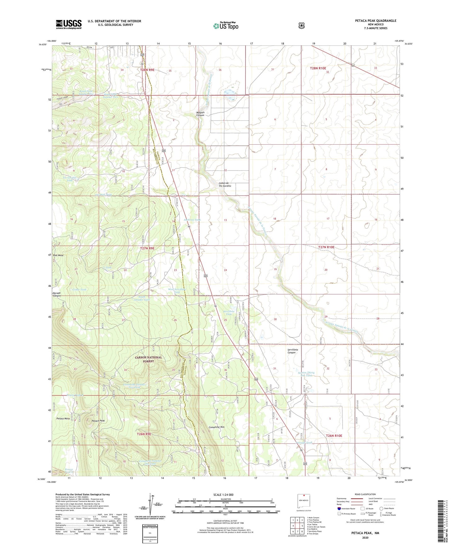
2020 topographic map quadrangle Petaca Peak in the state of New Mexico. Scale: 1:24000. Based on the newly updated USGS 7.5' US Topo map series, this map is in the following counties: Taos, Rio Arriba. The map contains contour data, water features, and other items you are used to seeing on USGS maps, but also has updated roads and other features. This is the next generation of topographic maps. Printed on high-quality waterproof paper with UV fade-resistant inks.
Quads adjacent to this one:
West: Las Tablas
Northwest: Mule Canyon
North: Tres Piedras
Northeast: Tres Piedras NE
East: Cerro De Los Taoses
Southeast: Tres Orejas
South: Servilleta Plaza
Southwest: La Madera
Contains the following named places: Ambrose Tank, Canon de Tio Gordito, Cedar Tank, Chambers, Comanche Number One Tank, Comanche Number Two Tank, L Tank, Old Well Tank, Owl Trick Tank, Petaca Mesa, Petaca Peak, Petaca Tank A, Petaca Tank B, Petaca Trick Tank, Rest Area Trick Tank, RG-29910 Water Well, Rincon Tank, Road Tank Number One, Road Tank Number Two, Section Thirty One Tank, Servilleta, Servilleta Canyon, Servilleta Tank, South Amador Tank, Tio Gordito Tank, Triangle Tank, West Servilleta Tank