MyTopo
Tres Piedras New Mexico US Topo Map
Couldn't load pickup availability
Also explore the Tres Piedras Forest Service Topo of this same quad for updated USFS data
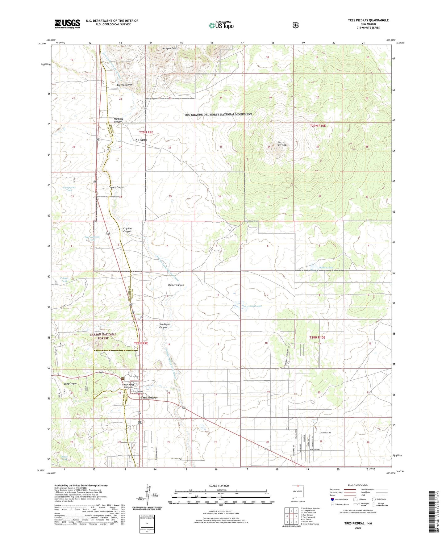
2023 topographic map quadrangle Tres Piedras in the state of New Mexico. Scale: 1:24000. Based on the newly updated USGS 7.5' US Topo map series, this map is in the following counties: Taos, Rio Arriba. The map contains contour data, water features, and other items you are used to seeing on USGS maps, but also has updated roads and other features. This is the next generation of topographic maps. Printed on high-quality waterproof paper with UV fade-resistant inks.
Quads adjacent to this one:
West: Mule Canyon
Northwest: San Antonio Mountain
North: La Segita Peaks
Northeast: Cerro De La Olla
East: Tres Piedras NE
Southeast: Cerro De Los Taoses
South: Petaca Peak
Southwest: Las Tablas
This map covers the same area as the classic USGS quad with code o36105f8.
Contains the following named places: Aqropyron Tank, Barela Canyon, Black Tank, Cerro del Aire, Cissell Lake, Coyote Canyon, Dan Johnson Tank, Davy Museum, El Grande Mine, Esquibel Canyon, Long Canyon, Martinez Canyon, No Agua, No Agua Peaks, Palmer Canyon, Palmer Tank, Rush, Seven Hills Perlite Mine, Tom Bryan Canyon, Tres Piedras, Tres Piedras Arroyo, Tres Piedras Canyon, Tres Piedras District Ranger Office, Tres Piedras Fire Department, Tres Piedras Post Office, Tres Piedras Railroad Water Tower, Tres Piedras Weather Station, U.S. Perlite Mine, United Perlite Mine, Unknown Tank, Wilson Lake