MyTopo
Reading Mountain New Mexico US Topo Map
Couldn't load pickup availability
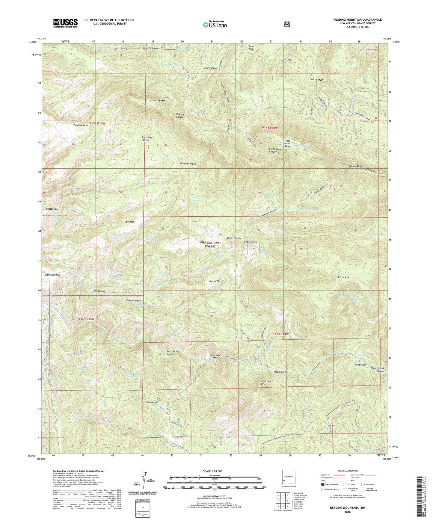
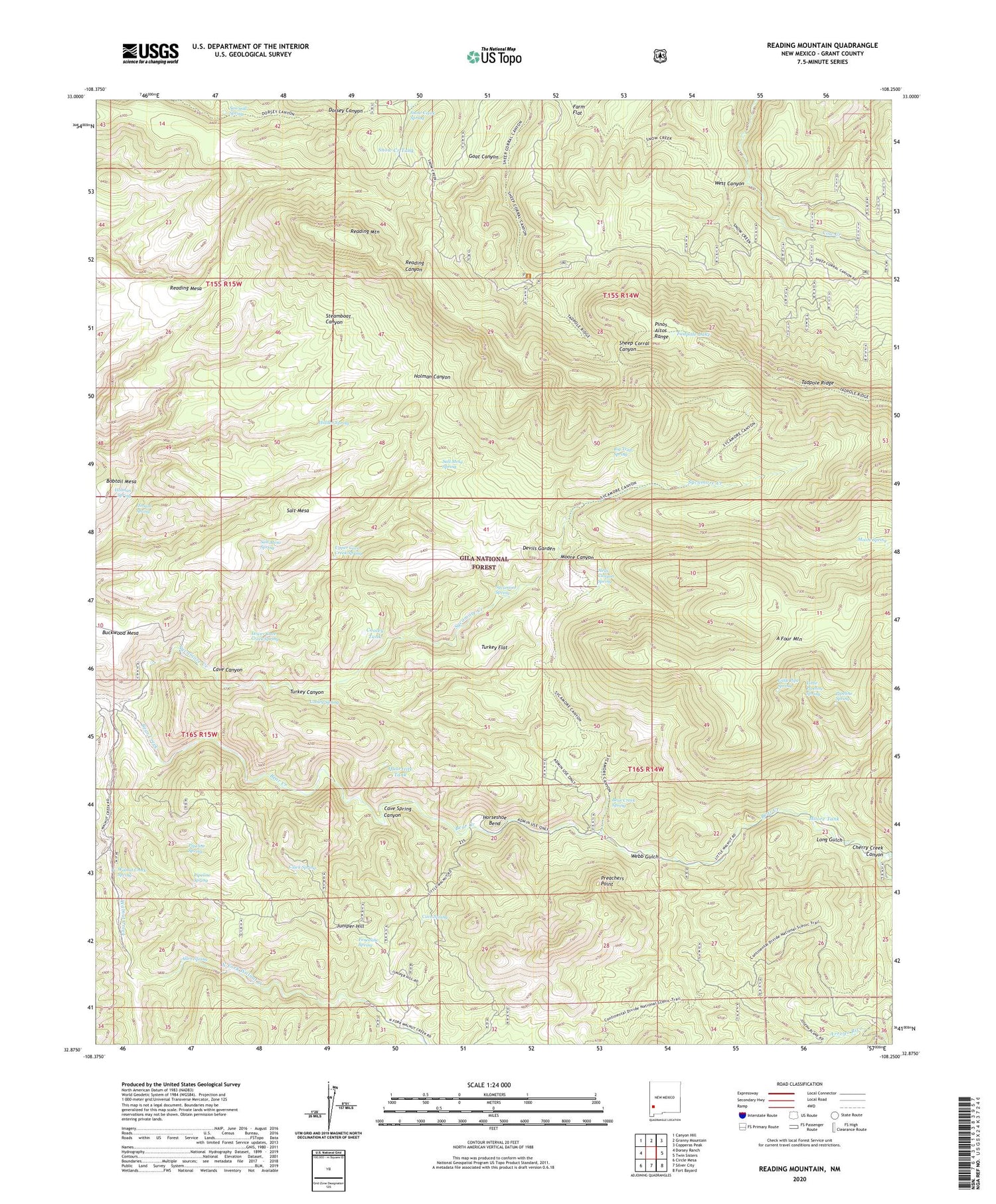
2020 topographic map quadrangle Reading Mountain in the state of New Mexico. Scale: 1:24000. Based on the newly updated USGS 7.5' US Topo map series, this map is in the following counties: Grant. The map contains contour data, water features, and other items you are used to seeing on USGS maps, but also has updated roads and other features. This is the next generation of topographic maps. Printed on high-quality waterproof paper with UV fade-resistant inks.
Quads adjacent to this one:
West: Dorsey Ranch
Northwest: Canyon Hill
North: Granny Mountain
Northeast: Copperas Peak
East: Twin Sisters
Southeast: Fort Bayard
South: Silver City
Southwest: Circle Mesa
Contains the following named places: A Four Mountain, Allen Spring, Arroyo Rico, Bear Creek Spring, Big Trap Spring, Bobtail Mesa, Buckwood Mesa, Cave Canyon, Cave Spring, Cave Spring Canyon, Cherry Creek, Cherry Creek Canyon, Clark Spring, Cooley Spring, Cooley Tank, Devils Garden, Fenceline Spring, Goat Canyon, Hells Canyon Spring, Hidden Spring, Holman Spring, Holmon Spring, Homon Spring, Horseshoe Bend, Juniper Hill, Little Pipe Spring, Little Pipeline Spring, Long Gulch, Lower Cave Creek Spring, Moore Canyon, Moore Spring, Moore Tank, North Fork Walnut Creek, Pipeline Spring, Preachers Point, Quartzite Tank, Reading Mesa, Reading Mountain, Salt Mesa, Salt Mesa Spring, Sawmill Spring, Snow Creek Cabin, Snow Creek Spring, Snow Creek Tank, Snow Creek Trail, Sycamore Creek, Sycamore Spring, Tadpole Lake, Tadpole Ridge, Turkey Canyon, Turkey Flat, Upper Cave Creek Spring, Walnut Creek, Walnut Creek Spring, Webb Gulch, Wilson Creek