MyTopo
Servilleta Plaza New Mexico US Topo Map
Couldn't load pickup availability
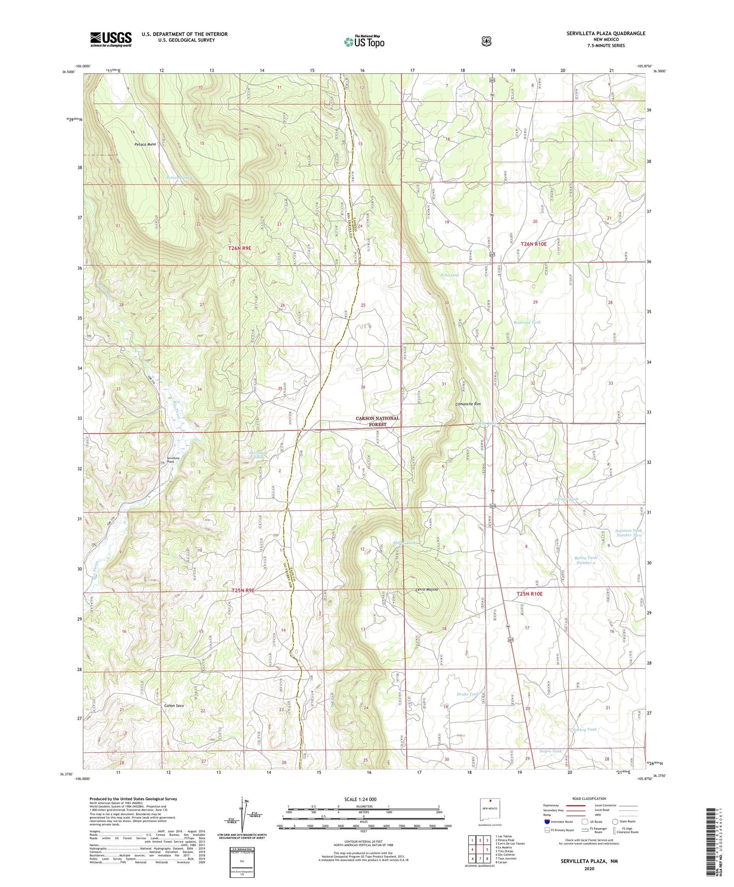
2020 topographic map quadrangle Servilleta Plaza in the state of New Mexico. Scale: 1:24000. Based on the newly updated USGS 7.5' US Topo map series, this map is in the following counties: Taos, Rio Arriba. The map contains contour data, water features, and other items you are used to seeing on USGS maps, but also has updated roads and other features. This is the next generation of topographic maps. Printed on high-quality waterproof paper with UV fade-resistant inks.
Quads adjacent to this one:
West: La Madera
Northwest: Las Tablas
North: Petaca Peak
Northeast: Cerro De Los Taoses
East: Tres Orejas
Southeast: Carson
South: Taos Junction
Southwest: Ojo Caliente
Contains the following named places: Bailey Tank, Bailey Tank Number 2, Blowout Number 3 Mine, Cerro Mojino, Comanche Rim, Comanche Water Well, Comanche Well, Corner Tank, Darkey Tank, Drake Tank, Indian Lake, Laura Crystal, Mojino Tank, Negro Tank, Pena tank, Petaca Tank C, Railroad Tank, Riverside One Through Four, Servilleta Plaza, Servilleta Tank