MyTopo
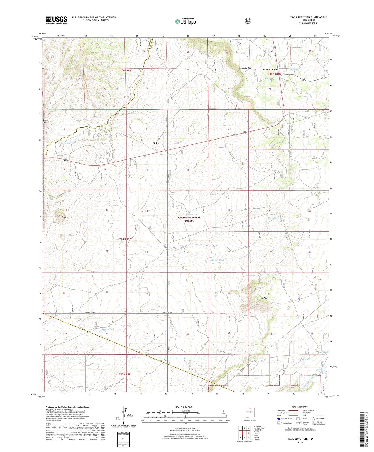
Taos Junction New Mexico US Topo Map
Couldn't load pickup availability
Also explore the Taos Junction Forest Service Topo of this same quad for updated USFS data
2023 topographic map quadrangle Taos Junction in the state of New Mexico. Scale: 1:24000. Based on the newly updated USGS 7.5' US Topo map series, this map is in the following counties: Taos, Rio Arriba. The map contains contour data, water features, and other items you are used to seeing on USGS maps, but also has updated roads and other features. This is the next generation of topographic maps. Printed on high-quality waterproof paper with UV fade-resistant inks.
Quads adjacent to this one:
West: Ojo Caliente
Northwest: La Madera
North: Servilleta Plaza
Northeast: Tres Orejas
East: Carson
Southeast: Trampas
South: Velarde
Southwest: Lyden
This map covers the same area as the classic USGS quad with code o36105c8.
Contains the following named places: Amador Windmill, Barranca Tank, Canada Embudo, Cerro Azul, Comanche Tank, Goats Point Prospect, Jose Tank, Kenyon Tank, Martinez Tank, McKenzie Tank, Mesa Vibora, RG-27285 Water Well, Sandlin Tank, Show Tank, Slater Tank, Solo, Taos Junction, Vibora Tank