MyTopo
Ute Park New Mexico US Topo Map
Couldn't load pickup availability
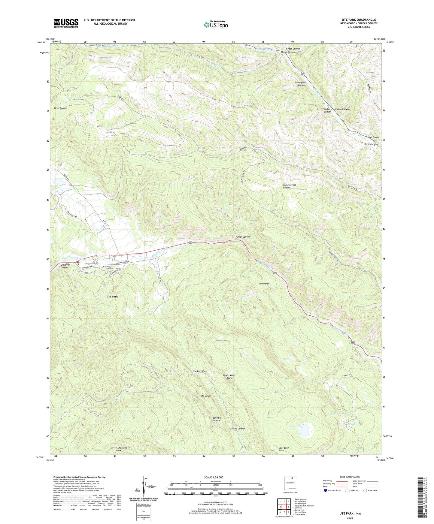
2020 topographic map quadrangle Ute Park in the state of New Mexico. Scale: 1:24000. Based on the newly updated USGS 7.5' US Topo map series, this map is in the following counties: Colfax. The map contains contour data, water features, and other items you are used to seeing on USGS maps, but also has updated roads and other features. This is the next generation of topographic maps. Printed on high-quality waterproof paper with UV fade-resistant inks.
Quads adjacent to this one:
West: Touch-Me-Not Mountain
Northwest: Baldy Mountain
North: Abreu Canyon
Northeast: House Canyon
East: Cimarron
Southeast: Coyote Mesa
South: Tooth of Time
Southwest: Garcia Peak
Contains the following named places: Anaconda Mine, Aspen Springs Trail Camp, Bear Canyon, Bents Camp, Black Jacks Hideout, Cedar Canyon, Cimarron Canyon, Cimarron Canyon Historical Marker, Cimarron Division, Cimarroncita, Colfax Fire Department District 3 Ute Park, Contention Mine, Corral Canyon, Deer Lake, Deer Lake Mesa, Devils Wash Basin, Garst Mine, Graveyard Canyon, Grouse Canyon, Harlan Trail Camp, Horse Canyon, Indian Canyon, Middle Ponil Creek, New Dean Trail Camp, Old Dean Trail Camp, Palisades Sill Historical Marker, Penitente Canyon, Philmont Scout Ranch, Philmont Scout Ranch Historical Marker, Ponil Base Camp, Pueblano Trail Camp, Sawmill Canyon, Sioux Trail Camp, The Bench, The Bench Trail Camp, Thunder Mine, Trail Canyon, Ute Creek, Ute Creek Ranch, Ute Creek Reservoir Dam, Ute Park, Ute Park Census Designated Place, Ute Park Pass, Ute Park Post Office, Vaca Pond, ZIP Code: 87749