MyTopo
Cimarron New Mexico US Topo Map
Couldn't load pickup availability
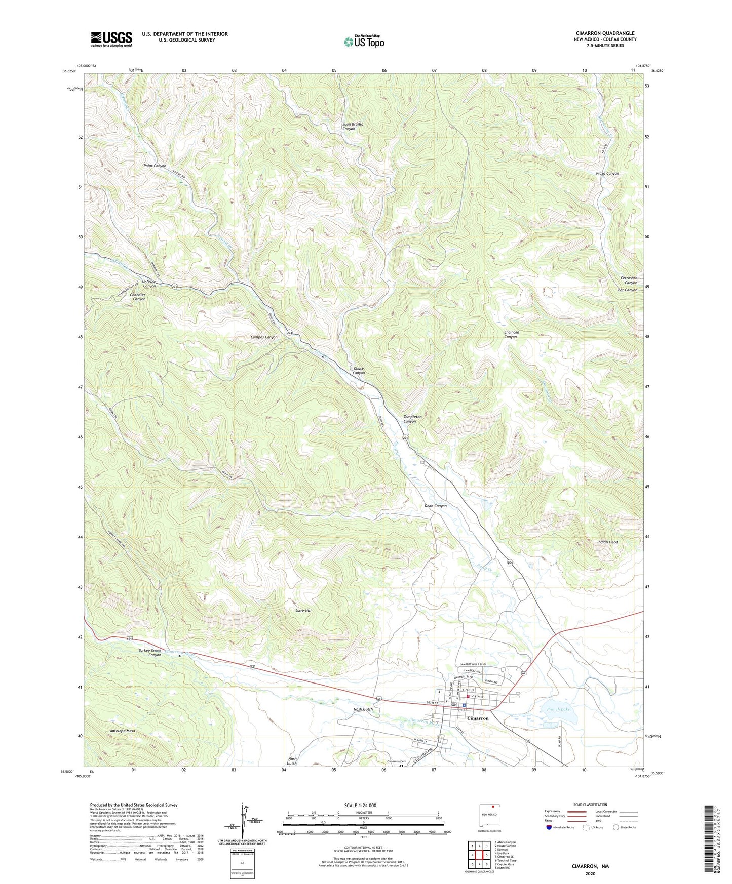
2023 topographic map quadrangle Cimarron in the state of New Mexico. Scale: 1:24000. Based on the newly updated USGS 7.5' US Topo map series, this map is in the following counties: Colfax. The map contains contour data, water features, and other items you are used to seeing on USGS maps, but also has updated roads and other features. This is the next generation of topographic maps. Printed on high-quality waterproof paper with UV fade-resistant inks.
Quads adjacent to this one:
West: Ute Park
Northwest: Abreu Canyon
North: House Canyon
Northeast: Dawson
East: Cimarron SE
Southeast: Miami NE
South: Coyote Mesa
Southwest: Tooth of Time
This map covers the same area as the classic USGS quad with code o36104e8.
Contains the following named places: Antelope Mesa, Bat Canyon, Blackjacks Hideout Historical Marker, Chandler Canyon, Chase, Chase Canyon, Cimarron, Cimarron Cemetery, Cimarron Elementary School, Cimarron High School, Cimarron Historical Marker, Cimarron Junior High School, Cimarron Mine, Cimarron Police Department, Cimarron Post Office, Cimarron Volunteer Ambulance Service, Cimarron Volunteer Fire Department, Cimarron Weather Station, Colfax County War Historical Marker, Compos Canyon, Dean Canyon, French Lake, French Lake Dam, Indian Head, Juan Brailla Canyon, McBride Canyon, Nash Gulch, North Ponil Creek, Old Mill Museum, Plaza Canyon, Polar Canyon, Rural Bookmobile Northeast, Saint James Hotel, Seton Memorial Library, Six Mile Gate, Slate Hill, South Ponil Creek, Templeton Canyon, Turkey Creek Canyon, United Methodist Church of Cimarron, Village of Cimarron, W S Ranch