MyTopo
Willard New Mexico US Topo Map
Couldn't load pickup availability
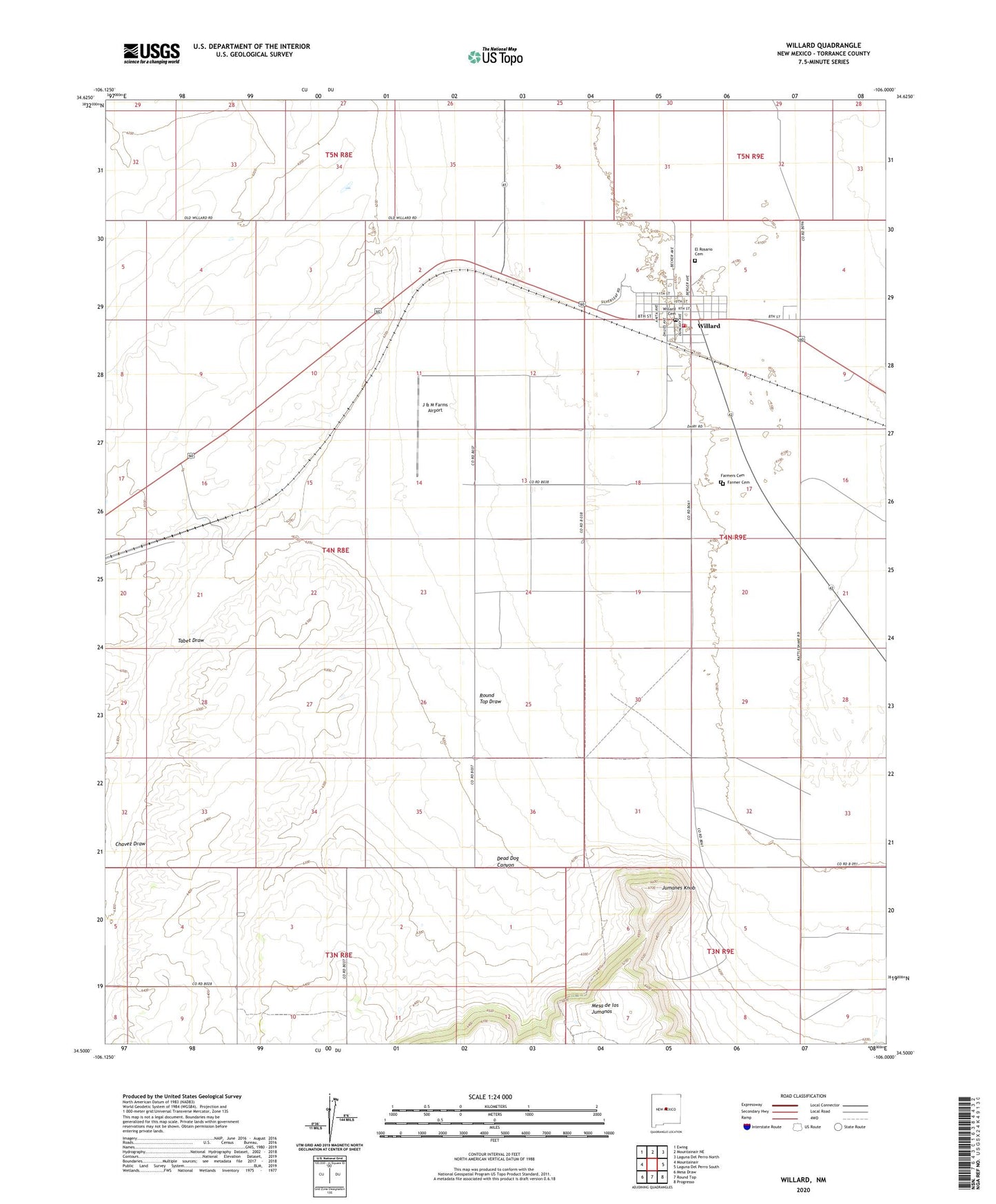
2020 topographic map quadrangle Willard in the state of New Mexico. Scale: 1:24000. Based on the newly updated USGS 7.5' US Topo map series, this map is in the following counties: Torrance. The map contains contour data, water features, and other items you are used to seeing on USGS maps, but also has updated roads and other features. This is the next generation of topographic maps. Printed on high-quality waterproof paper with UV fade-resistant inks.
Quads adjacent to this one:
West: Mountainair
Northwest: Ewing
North: Mountainair NE
Northeast: Laguna Del Perro North
East: Laguna Del Perro South
Southeast: Progresso
South: Round Top
Southwest: Mesa Draw
Contains the following named places: 10004 Water Well, 10005 Water Well, 10019 Water Well, Brandenburg Ranch, Broncho, Bronco Pit, Chavez Draw, Dead Dog Canyon, El Rosario Cemetery, Estes Windmill, Farmer Cemetery, Farmers Cemetery, Gustin Ranch, Hibler Ranch, J & M Farms Airport, Jackson Ranch, Jumanes Knob, Maxey Ranch, Round Top Draw, Tabet Draw, Village of Willard, Willard, Willard Baptist Church, Willard Cemetery, Willard Fire Department, Willard Post Office, Willard Substation