MyTopo
Mountainair NE New Mexico US Topo Map
Couldn't load pickup availability
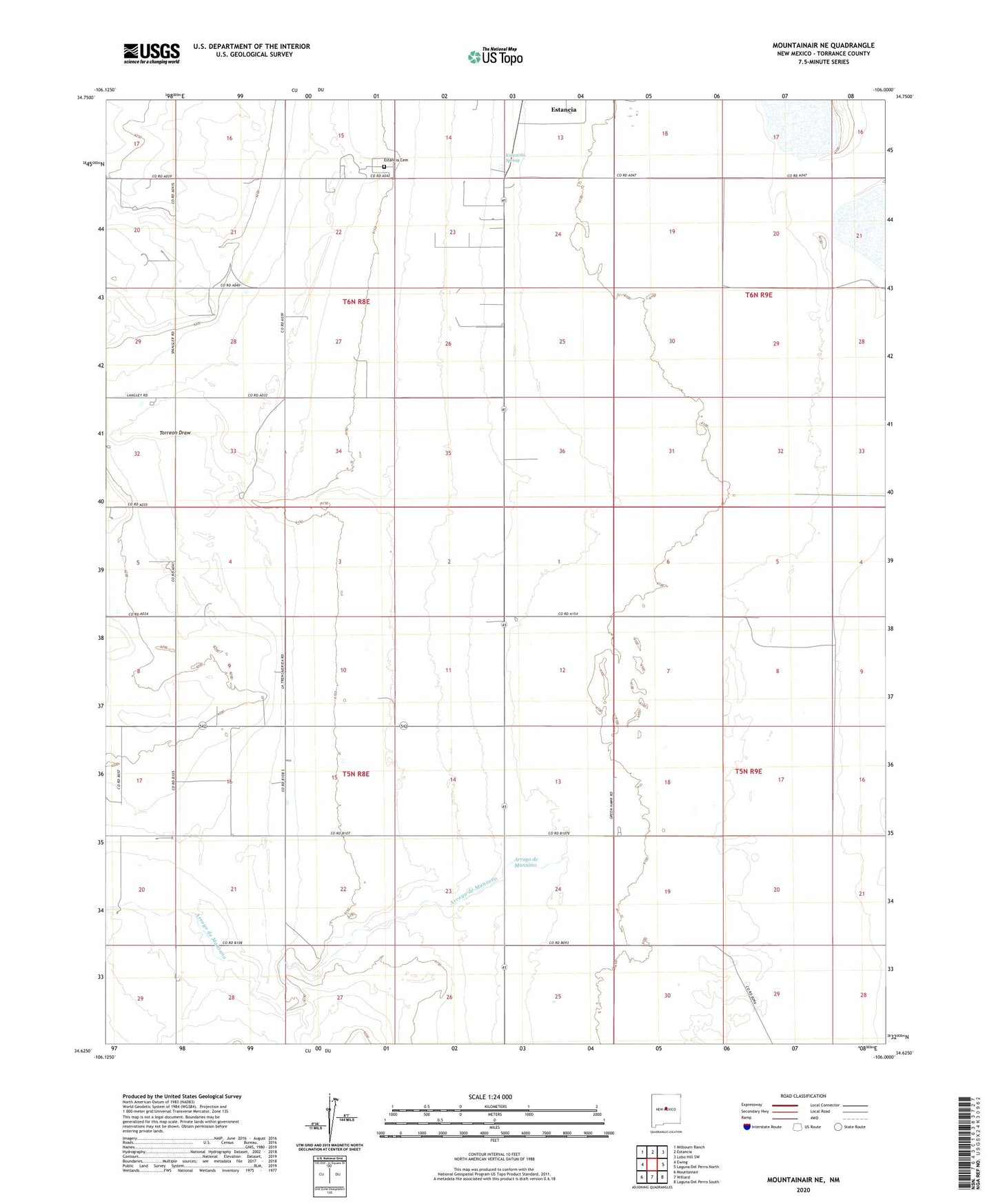
2023 topographic map quadrangle Mountainair NE in the state of New Mexico. Scale: 1:24000. Based on the newly updated USGS 7.5' US Topo map series, this map is in the following counties: Torrance. The map contains contour data, water features, and other items you are used to seeing on USGS maps, but also has updated roads and other features. This is the next generation of topographic maps. Printed on high-quality waterproof paper with UV fade-resistant inks.
Quads adjacent to this one:
West: Ewing
Northwest: Milbourn Ranch
North: Estancia
Northeast: Lobo Hill SW
East: Laguna Del Perro North
Southeast: Laguna Del Perro South
South: Willard
Southwest: Mountainair
This map covers the same area as the classic USGS quad with code o34106f1.
Contains the following named places: 100002 Water Well, 10027 Water Well, 10033 Water Well, 10036 Water Well, 10038 Water Well, 10042 Water Well, 10043 Water Well, 10044 Water Well, 10045 Water Well, 10047 Water Well, 10048 Water Well, 10051 Water Well, 10064 Water Well, 10066 Water Well, 10074 Water Well, 10075 Water Well, 10099 Water Well, Arroyo de Manzano, Berkshire Windmill, Estancia Cemetery, Estancita Spring, Moe Ranch, Spruill Ranch, Torreon Draw, Water Well Number 2