MyTopo
Alexander New York US Topo Map
Couldn't load pickup availability
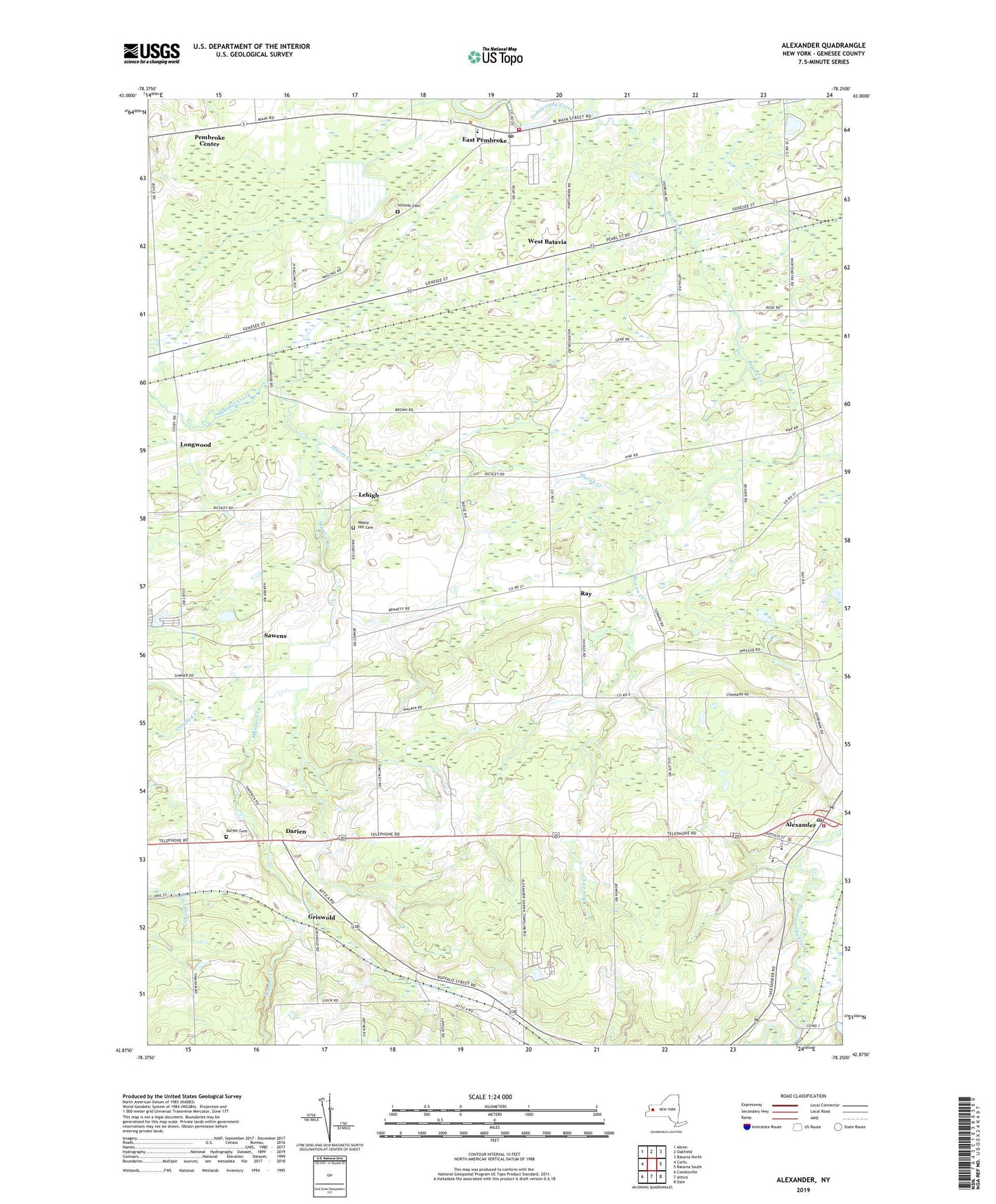
2019 topographic map quadrangle Alexander in the state of New York. Scale: 1:24000. Based on the newly updated USGS 7.5' US Topo map series, this map is in the following counties: Genesee. The map contains contour data, water features, and other items you are used to seeing on USGS maps, but also has updated roads and other features. This is the next generation of topographic maps. Printed on high-quality waterproof paper with UV fade-resistant inks.
Quads adjacent to this one:
West: Corfu
Northwest: Akron
North: Oakfield
Northeast: Batavia North
East: Batavia South
Southeast: Dale
South: Attica
Southwest: Cowlesville
Contains the following named places: Alexander, Alexander Classical School, Alexander Elementary School, Alexander Fire Department, Alexander Middle School - High School, Alexander Post Office, Alexander United Methodist Church, Atherton Farms, Baker Brook, Bowen Creek, Darien, Darien Cemetery, East Pembroke, East Pembroke Fire Department, East Pembroke Post Office, Griswold, Hillside Cemetery, Huron Creek, Lehigh, Lehigh Station, Longwood, Maple Hill Cemetery, North Darien, North Darien Baptist Church, Northland Farm, Pembroke Center, Ray, Sawens, School Number 11, School Number 16, School Number 8, Skyline Camping Resort, Town of Alexander, Village of Alexander, West Bank Mobile Home Park, West Batavia, ZIP Code: 14005