MyTopo
Dale New York US Topo Map
Couldn't load pickup availability
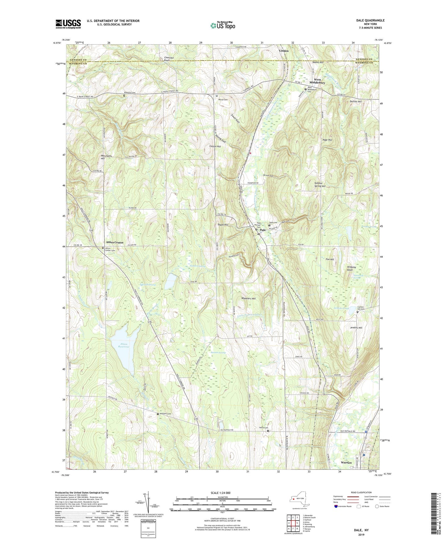
2023 topographic map quadrangle Dale in the state of New York. Scale: 1:24000. Based on the newly updated USGS 7.5' US Topo map series, this map is in the following counties: Wyoming, Genesee. The map contains contour data, water features, and other items you are used to seeing on USGS maps, but also has updated roads and other features. This is the next generation of topographic maps. Printed on high-quality waterproof paper with UV fade-resistant inks.
Quads adjacent to this one:
West: Attica
Northwest: Alexander
North: Batavia South
Northeast: Stafford
East: Wyoming
Southeast: Castile
South: Warsaw
Southwest: Johnsonburg
This map covers the same area as the classic USGS quad with code o42078g2.
Contains the following named places: Attica Center, Attica Center Cemetery, Attica Reservoir, Bannan Swamp, Beehive Crossing, Belknap Crossing, Bradley Swamp, Brainard Cemetery, Carlton Hill Cemetery, Casey's Airport, Chestnut Knoll, Colton Hill, Dale, Dale Cemetery, Dale Gulf, Dale Pioneer Cemetery, Dale Post Office, Dale Valley, Dersam Gulf, Doyle Hill, Dream Lake Campground, Dusing Gulf, Dutton Hill, Eastman Corners, Edwards Swamp, Ewell Gulf, Fox Hill, Full Gospel Community Church, Gouinlocks Pond, Hatch Cemetery, Hubbards Pond, Idlewood Acres, Jenkins Hill, Jenkins Pond, Kennedy Gulf, Kingsley Knoll, Merchants Hill, Middlebury Brook, Millers Crossing, Mount Zion Tabernacle, New York State Police Troop A Zone 2 Warsaw Station, Nichols Corners, Orangeville Center, Page Hill, Pflaum Gulf, Pierce Corners, School Number 1, School Number 11, School Number 15, School Number 4, School Number 6, School Number 7, Sickleys Corners, Skates Hill, Smith Gulf, Sulphur Spring Hill, Tamarack Swamp, The Church of Jesus Christ of Latter Day Saints, Thompsons Crossing, Town of Attica, Town of Middlebury, Vernal Cemetery, Vernal Corners, Wards Brook, Warsaw Village Sewage Treatment Plant, Webbers Swamp, West Middlebury, West Middlebury Cemetery, Wheelers Hill, Williams Cemetery, Williams Corners, Wyoming County Community Health System, Wyoming County Community Hospital Skilled Nursing Facility, Wyoming Hook and Ladder Volunteer Fire Company Station 2, Ziegler Farms, ZIP Code: 14039