MyTopo
Barker New York US Topo Map
Couldn't load pickup availability
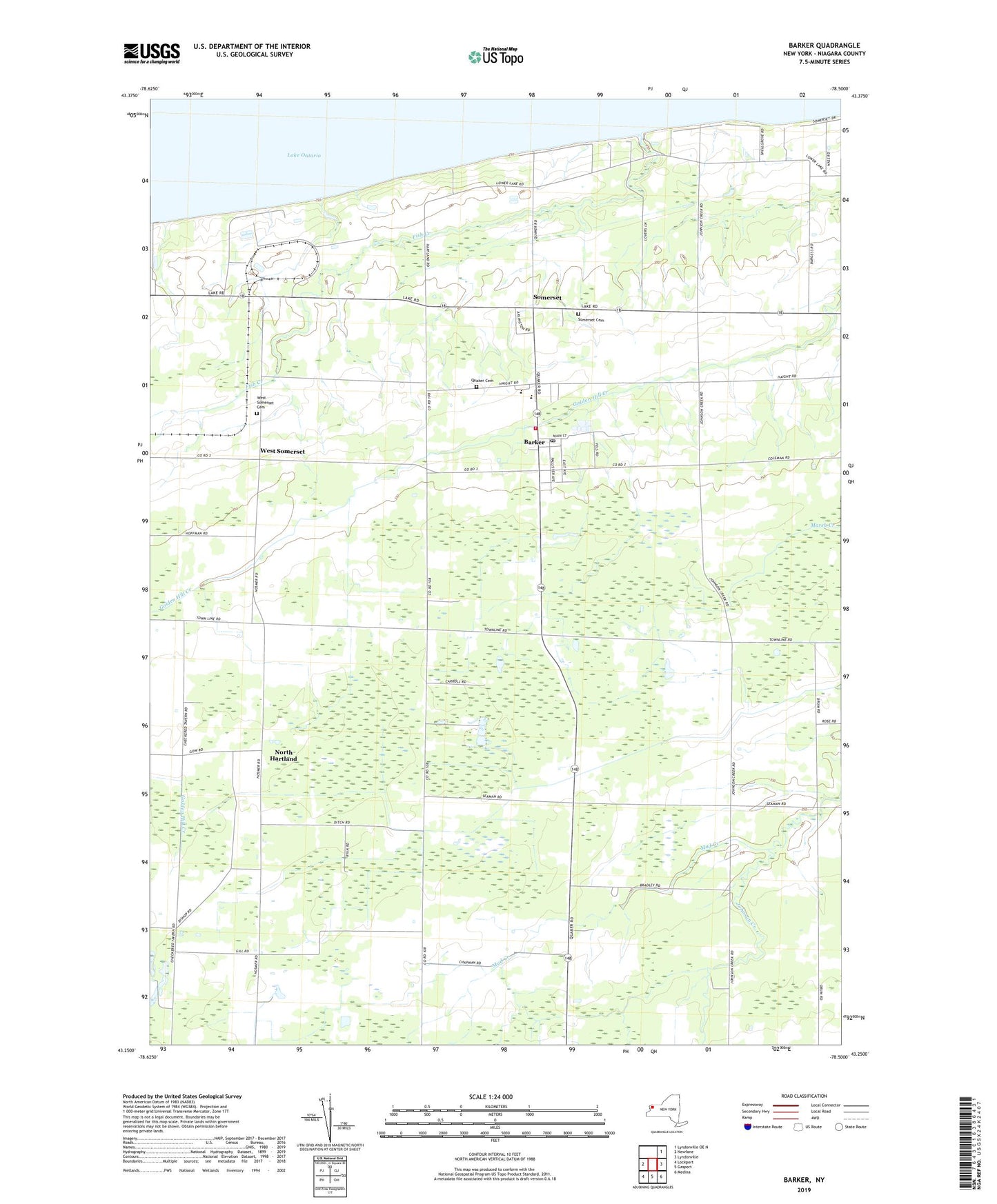
2019 topographic map quadrangle Barker in the state of New York. Scale: 1:24000. Based on the newly updated USGS 7.5' US Topo map series, this map is in the following counties: Niagara. The map contains contour data, water features, and other items you are used to seeing on USGS maps, but also has updated roads and other features. This is the next generation of topographic maps. Printed on high-quality waterproof paper with UV fade-resistant inks.
Quads adjacent to this one:
West: Newfane
Northeast: Lyndonville OE N
East: Lyndonville
Southeast: Medina
South: Gasport
Southwest: Lockport
Contains the following named places: Barker, Barker Assembly of God, Barker Central School, Barker Central School Airport, Barker Fire Department, Barker Free Library, Barker Post Office, Camp Kenan, Faith United Methodist Church, First Baptist Church, Fish Creek, Lake Breeze Mobile Home Park, Major Field, Mud Creek, North Hartland, Quaker Cemetery, Quaker Road Church, Ray Fitch Farms, Saint Patrick's Church, School Number 11, School Number 18, School Number 2, Somerset, Somerset - Barker Sewer District Wastewater Treatment Plant, Somerset Cemetery, South Somerset, Sunset Memorial Tabernacle, Teacup Farm, Torrey Farms, Town of Hartland, Town of Somerset, Village of Barker, West Somerset, West Somerset Cemetery, ZIP Codes: 14008, 14012