MyTopo
Bayville New York US Topo Map
Couldn't load pickup availability
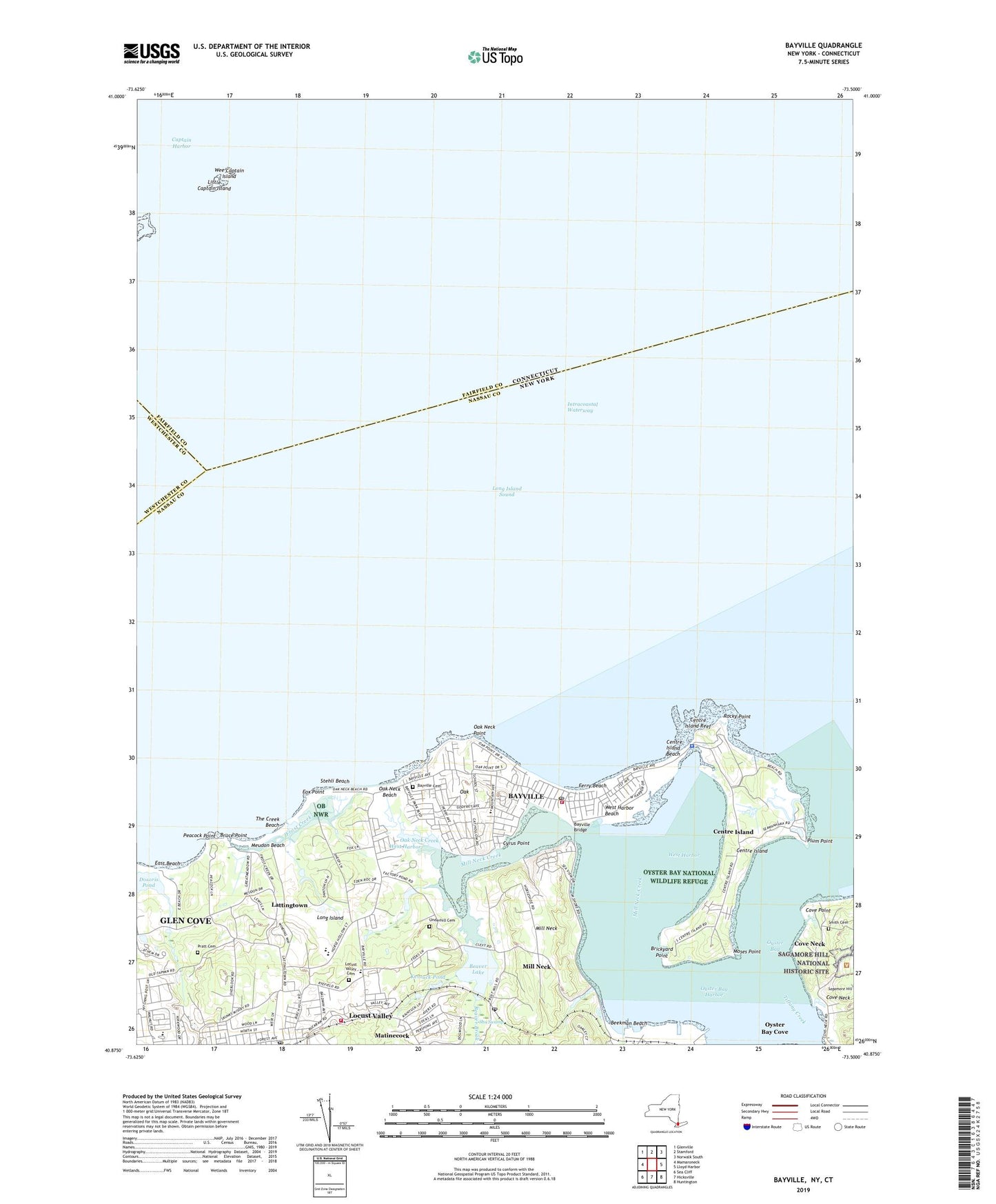
2019 topographic map quadrangle Bayville in the state of New York. Scale: 1:24000. Based on the newly updated USGS 7.5' US Topo map series, this map is in the following counties: Nassau, Fairfield, Westchester. The map contains contour data, water features, and other items you are used to seeing on USGS maps, but also has updated roads and other features. This is the next generation of topographic maps. Printed on high-quality waterproof paper with UV fade-resistant inks.
Quads adjacent to this one:
West: Mamaroneck
Northwest: Glenville
North: Stamford
Northeast: Norwalk South
East: Lloyd Harbor
Southeast: Huntington
South: Hicksville
Southwest: Sea Cliff
Contains the following named places: Bailey Arboretum County Park, Bayville, Bayville Aquatic Club, Bayville Bridge, Bayville Cemetery, Bayville Church, Bayville Elementary School, Bayville Fire Department, Bayville Free Library, Bayville Post Office, Bayville Rod and Gun Club, Bayville Village Hall, Beaver Brook, Beaver Lake, Beckman Beach Town Park, Beekman Beach, Brickyard Point, Bruce Point, Centre Island, Centre Island Beach, Centre Island Police Department, Centre Island Police Station, Centre Island Reef, Centre Island Town Park, Cove Neck, Cove Point, Cyrus Point, East Beach, Ferry Beach, Fox Point, Frost Creek, Gebbs Estate, Glen Cove Center for Nursing and Rehabilitation, Glen Cove Golf Course, Guther Boat House, Guther Estate, Island Swamp Brook, Jones Manor Adult Home, Jones Manor on the Sound Assisted Living Facility, Kentuck Pond, Lattingtown, Locust Valley, Locust Valley Cemetery, Locust Valley Census Designated Place, Locust Valley Elementary School, Locust Valley Fire Station, Locust Valley High School, Locust Valley Library, Locust Valley Post Office, Locust Valley School, Matinecock, Meudon Beach, Mill Neck, Mill Neck Creek, Mill Neck Manor School, Mill Neck Post Office, Mill Neck Preserve, Mill Neck Station, Moses Point, Oak, Oak Neck Beach, Oak Neck Creek, Oak Neck Point, Oyster Bay Harbor, Oyster Bay National Wildlife Refuge, Oyster Bay Station, Oyster Bay Yacht Club, Peacock Point, Pine Island, Plum Point, Pratt Cemetery, Reformed Church of Locust Valley, Rocky Point, Sagamore Hill, Saint Gertrude's Roman Catholic Church, Saint Johns Church, Saint Josephats Monastery, Seawanhaka - Corinthian Yacht Club, Shu Swamp, Shu Swamp Nature Preserve, Smith Cemetery, Soundside Beach Park, Spring Lake, Stehli Beach, Stehli Town Beach, The Creek Beach, The Creek Club, Theodore Roosevelt Memorial Park, Underhill Cemetery, Village of Bayville, Village of Centre Island, Village of Lattingtown, Village of Mill Neck, Village Woods Park, West Harbor, West Harbor Beach, ZIP Codes: 11560, 11709, 11765