MyTopo
Bliss New York US Topo Map
Couldn't load pickup availability
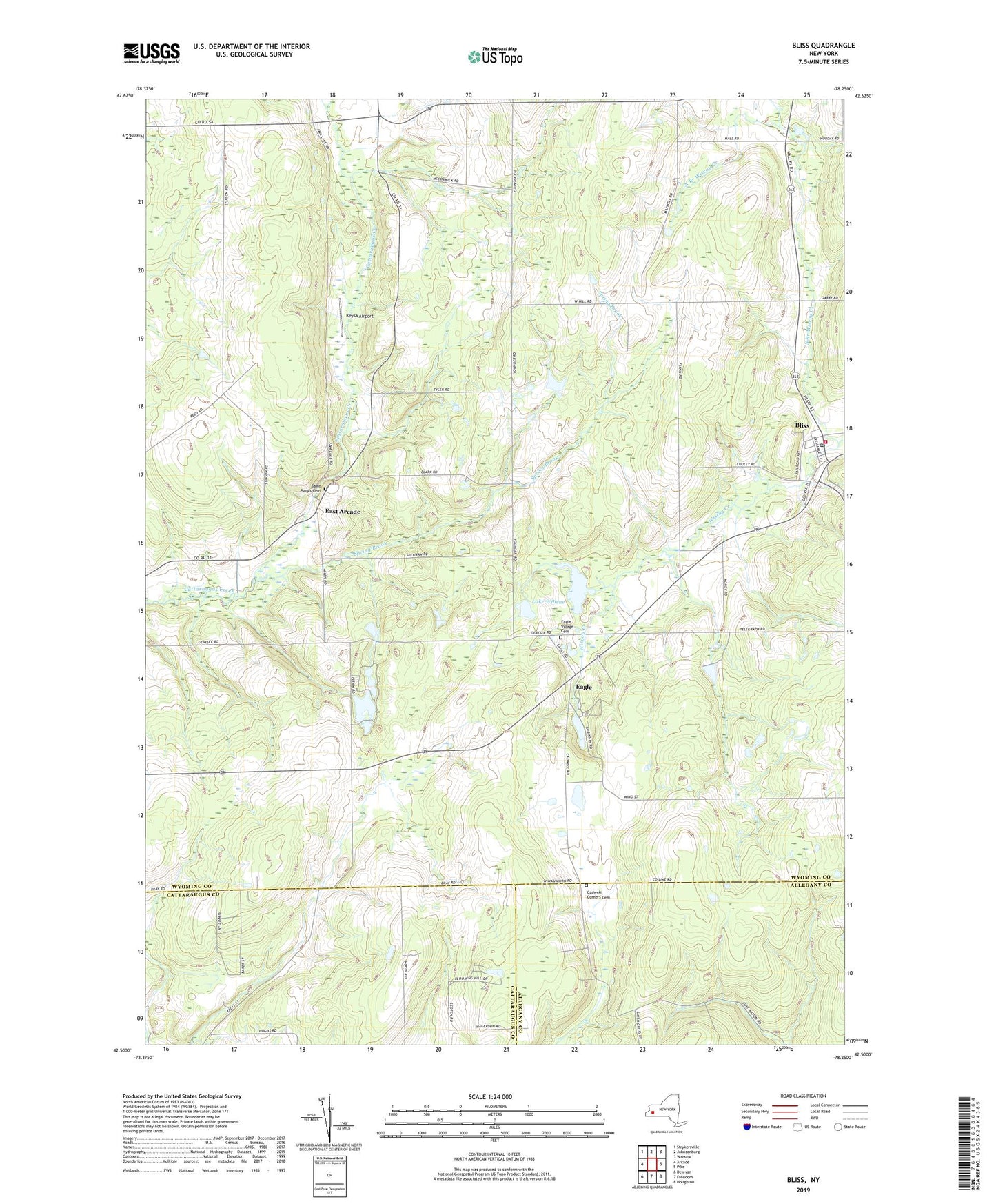
2019 topographic map quadrangle Bliss in the state of New York. Scale: 1:24000. Based on the newly updated USGS 7.5' US Topo map series, this map is in the following counties: Wyoming, Cattaraugus, Allegany. The map contains contour data, water features, and other items you are used to seeing on USGS maps, but also has updated roads and other features. This is the next generation of topographic maps. Printed on high-quality waterproof paper with UV fade-resistant inks.
Quads adjacent to this one:
West: Arcade
Northwest: Strykersville
North: Johnsonburg
Northeast: Warsaw
East: Pike
Southeast: Houghton
South: Freedom
Southwest: Delevan
Contains the following named places: Bliss, Bliss Census Designated Place, Bliss Fire Department Eagle Hose Company 1, Bliss Post Office, Cadwell Corners Cemetery, Cadwells Corners, Camp Deerwood Forest, Davis Valley Farm, Dream Lake, Dziedzic Farms, Eagle, Eagle Village Cemetery, East Arcade, East Arcade Airport, Good News Camp, Hiram Lake, Keysa Airport, Lake Willene, North Branch Wiscoy Creek, Saint Mary's Catholic Church, Saint Mary's Cemetery, Spring Brook, Waldos Corners, WEZQ-FM (Town of Wethersfield), Zielenieski Farms