MyTopo
Delevan New York US Topo Map
Couldn't load pickup availability
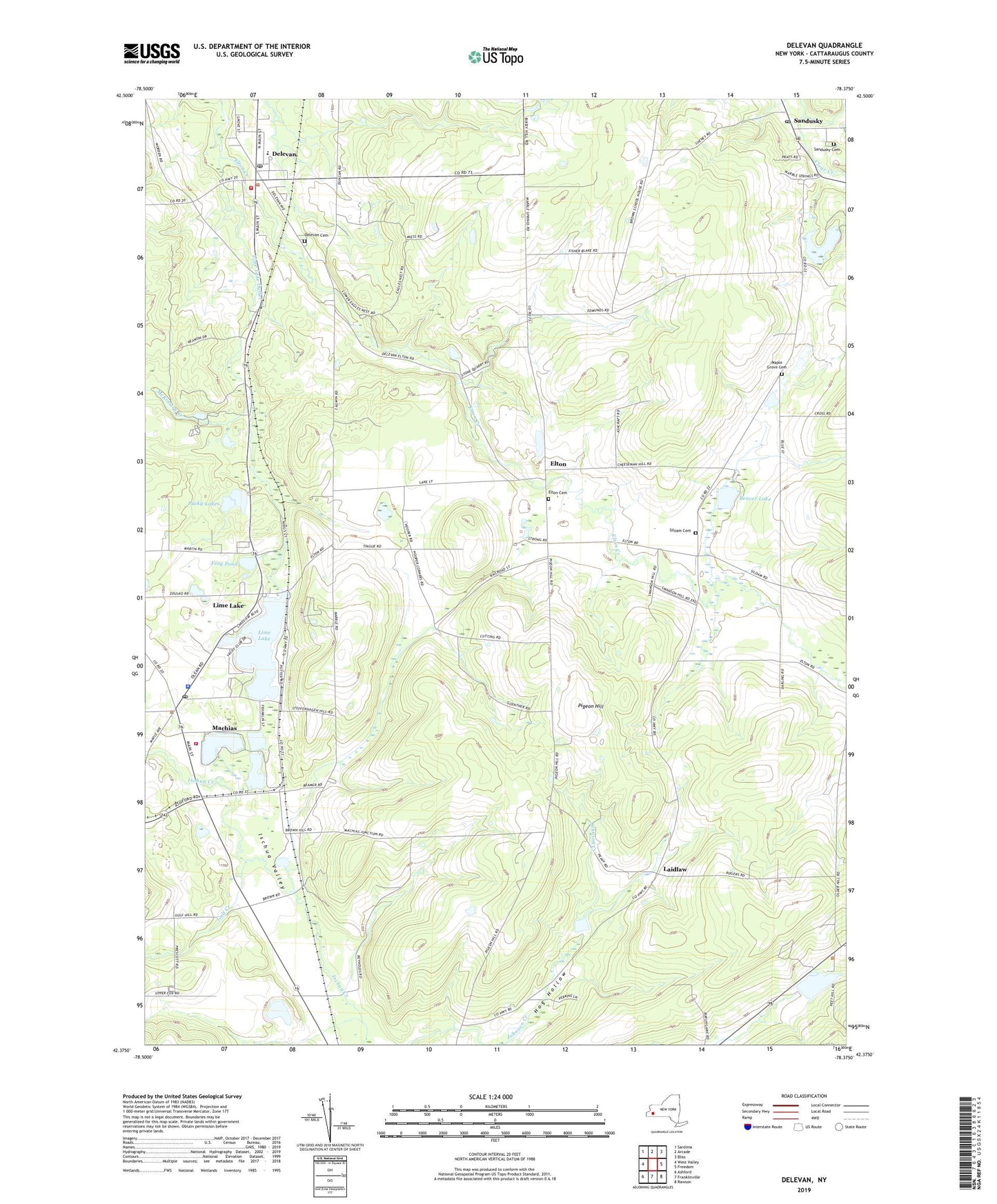
2023 topographic map quadrangle Delevan in the state of New York. Scale: 1:24000. Based on the newly updated USGS 7.5' US Topo map series, this map is in the following counties: Cattaraugus. The map contains contour data, water features, and other items you are used to seeing on USGS maps, but also has updated roads and other features. This is the next generation of topographic maps. Printed on high-quality waterproof paper with UV fade-resistant inks.
Quads adjacent to this one:
West: West Valley
Northwest: Sardinia
North: Arcade
Northeast: Bliss
East: Freedom
Southeast: Rawson
South: Franklinville
Southwest: Ashford
This map covers the same area as the classic USGS quad with code o42078d4.
Contains the following named places: Beaver Lake, Calvary Community Chapel, Camp Vick, Dam Number Two, Delevan, Delevan - Yorkshire Public Library, Delevan Baptist Church, Delevan Cemetery, Delevan Elementary School, Delevan Fire Fighters Training, Delevan High School, Delevan Post Office, Delevan United Methodist Church, Delevan Volunteer Fire Department, Elton, Elton Cemetery, Elton Station, Farmersville, First Christian Church, Freedom Post Office, Frog Pond, Gulf Creek, Hog Hollow, Holy Family Church, Hotel Delevan, King Memorial Library, Kingdom Hall of Jehovahs Witnesses, Laidlaw, Lime Lake, Lime Lake Census Designated Place, Lime Lake Outlet, Lime Lake-Machias Census Designated Place, Lucky Lakes, Machias, Machias Census Designated Place, Machias Junction, Machias Post Office, Machias Volunteer Fire Department, Maple Grove Cemetery, McKinstry Creek, New York State Police Troop A Zone 4 Machias Station, Pigeon Hill, Saint Christophers Church, Saint Pius X School, Sandusky, Sandusky Baptist Church, Sandusky Cemetery, Siloam Cemetery, Skim Lake, The Pines Healthcare and Rehabilitation Centers - Machias Campus, Town of Farmersville, Town of Freedom, Village of Delevan, ZIP Code: 14042