MyTopo
Brushton New York US Topo Map
Couldn't load pickup availability
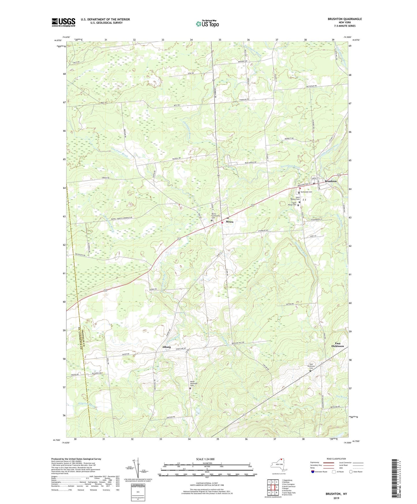
2019 topographic map quadrangle Brushton in the state of New York. Scale: 1:24000. Based on the newly updated USGS 7.5' US Topo map series, this map is in the following counties: Franklin, St. Lawrence. The map contains contour data, water features, and other items you are used to seeing on USGS maps, but also has updated roads and other features. This is the next generation of topographic maps. Printed on high-quality waterproof paper with UV fade-resistant inks.
Quads adjacent to this one:
West: North Lawrence
Northwest: Hogansburg
North: Bombay
Northeast: Fort Covington
East: Bangor
Southeast: Santa Clara
South: Saint Regis Falls
Southwest: Nicholville
Contains the following named places: Alburg, Alburg Brook, Brushton, Brushton Post Office, Brushton Volunteer Fire Department, Brushton-Moira School, East Dickinson Cemetery, Evangelical Wesleyan Church, First Christian Church, Irish Corners, Joy Brook, Moira, Moira Community Cemetery, Moira Post Office, Moira Volunteer Fire Department, North Dickinson Cemetery, Potter School, Saint Marys Cemetery, Saint Mary's Church, Saint Mary's Parish Center, Saint Peters Cemetery, Sand Hill Church, School Number 10, School Number 11, School Number 3, School Number 5, School Number 6, School Number 7, School Number 8, School Number 9, Stony Brook, Sunnyside Cemetery, Town of Moira, Ursone Airport, Village of Brushton, ZIP Codes: 12916, 12957