MyTopo
North Lawrence New York US Topo Map
Couldn't load pickup availability
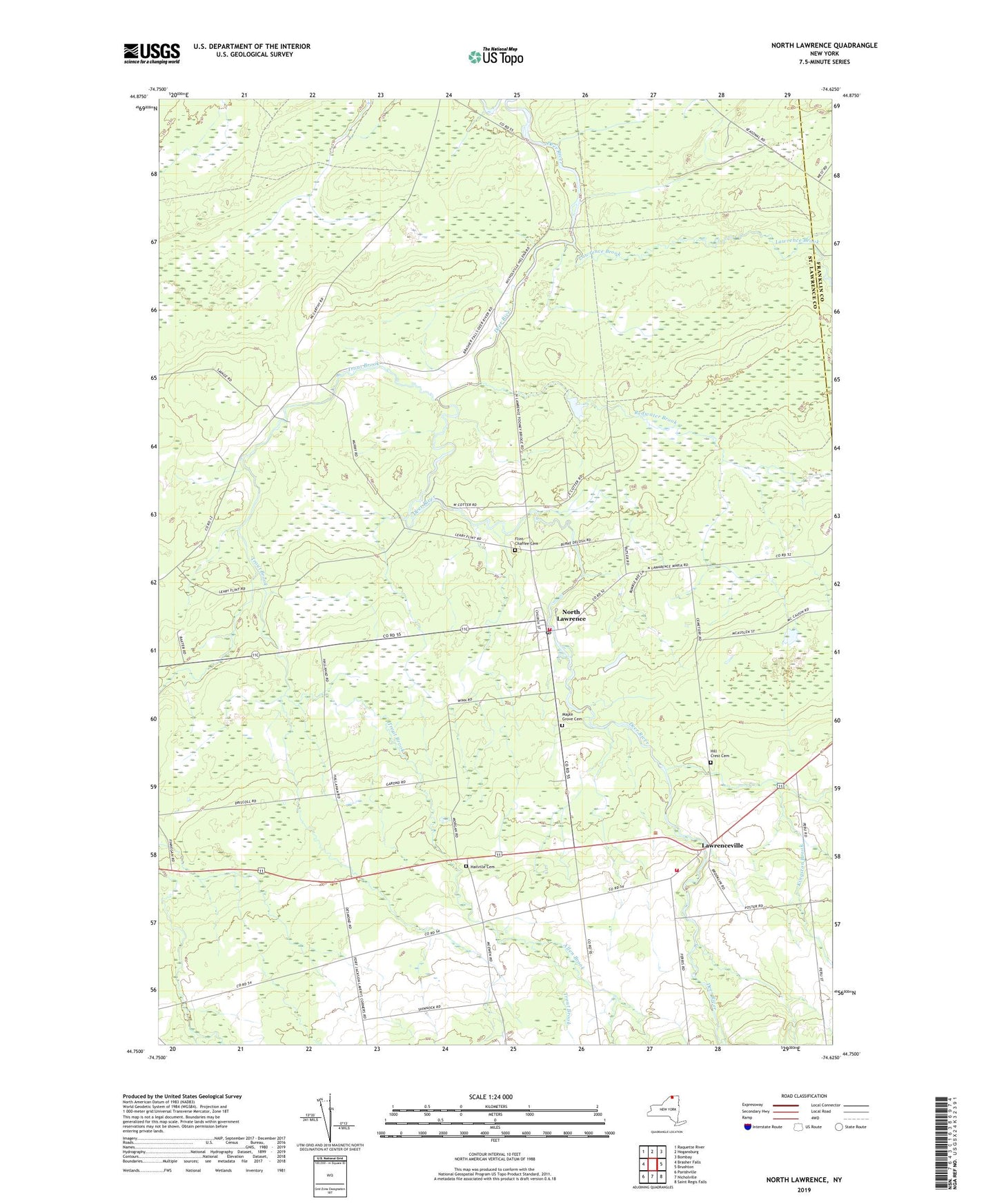
2023 topographic map quadrangle North Lawrence in the state of New York. Scale: 1:24000. Based on the newly updated USGS 7.5' US Topo map series, this map is in the following counties: St. Lawrence, Franklin. The map contains contour data, water features, and other items you are used to seeing on USGS maps, but also has updated roads and other features. This is the next generation of topographic maps. Printed on high-quality waterproof paper with UV fade-resistant inks.
Quads adjacent to this one:
West: Brasher Falls
Northwest: Raquette River
North: Hogansburg
Northeast: Bombay
East: Brushton
Southeast: Saint Regis Falls
South: Nicholville
Southwest: Parishville
This map covers the same area as the classic USGS quad with code o44074g6.
Contains the following named places: Allen Brook, Coteys Corner, Flint Chaffee Cemetery, Hailville Cemetery, Hill Crest Cemetery, Kingston Brook, Laverys Corner, Lawrence Brook, Lawrence Christian Fellowship, Lawrenceville, Maple Grove Cemetery, McEwens Corner, North Lawrence, North Lawrence Post Office, Redwater Brook, School Number 10, School Number 19, School Number 2, School Number 22, School Number 7, School Number 9, Taylors Corner, Toomey Bridge, Town of Lawrence, Trout Brook, Wagstaff Corner, Walter F Pratt Memorial Forest, ZIP Code: 12967