MyTopo
Cayuga New York US Topo Map
Couldn't load pickup availability
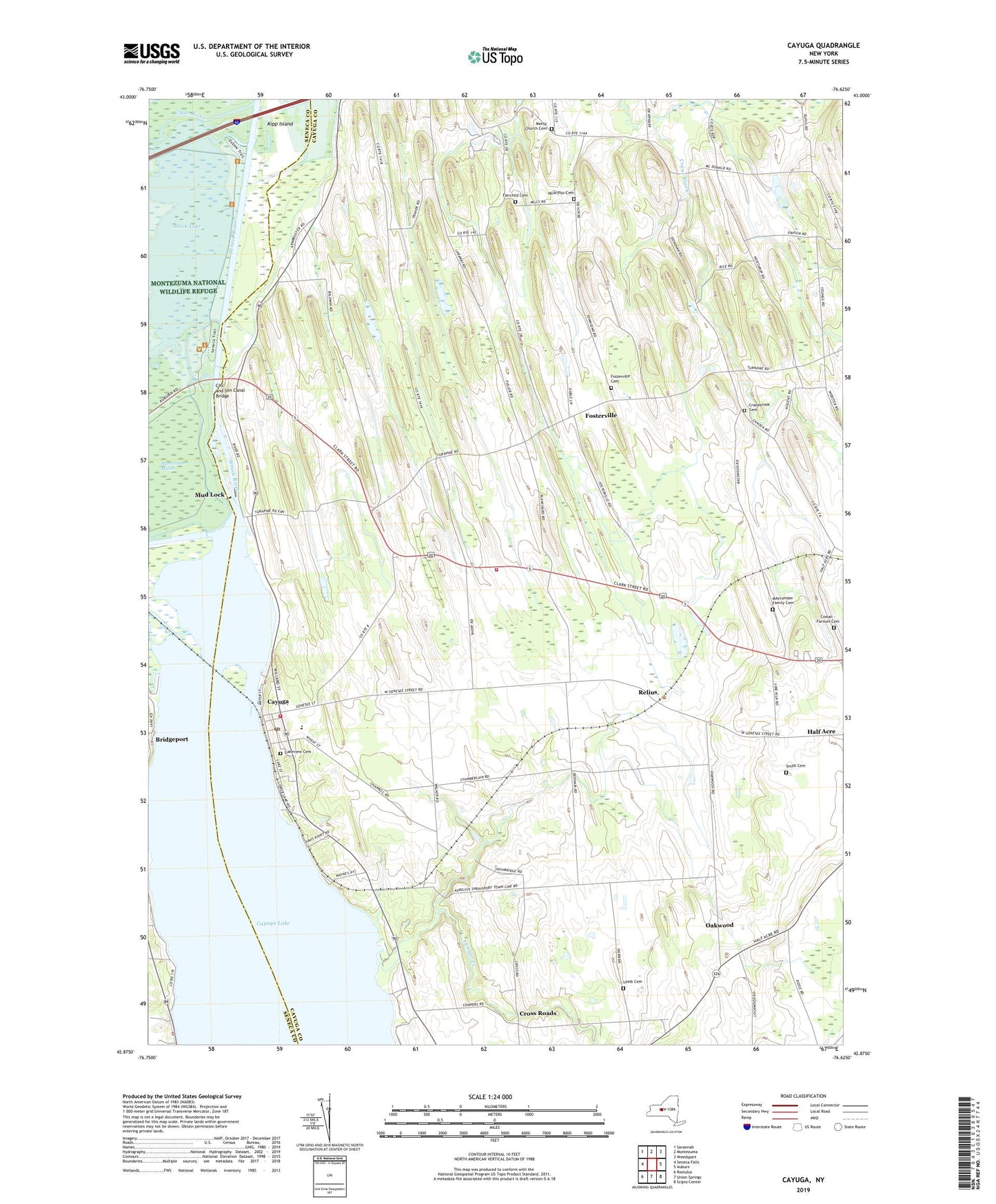
2019 topographic map quadrangle Cayuga in the state of New York. Scale: 1:24000. Based on the newly updated USGS 7.5' US Topo map series, this map is in the following counties: Cayuga, Seneca. The map contains contour data, water features, and other items you are used to seeing on USGS maps, but also has updated roads and other features. This is the next generation of topographic maps. Printed on high-quality waterproof paper with UV fade-resistant inks.
Quads adjacent to this one:
West: Seneca Falls
Northwest: Savannah
North: Montezuma
Northeast: Weedsport
East: Auburn
Southeast: Scipio Center
South: Union Springs
Southwest: Romulus
Contains the following named places: Aurelius Fire Department West Station, Beacon Bay Marina, Bennett's Mobile Court, Black Lake, Cay and Sen Canal Bridge, Cayuga, Cayuga Campground Marina, Cayuga Elementary School, Cayuga Fire Department, Cayuga Post Office, Clyde River, Cowan - Farnum Cemetery, Cranebrook Cemetery, Cranebrook Golf Course, Cranebrook Tree Farm, Cross Roads, Demont Creek, Fairchild Cemetery, Finger Lakes Drive-In, Fosterville, Fosterville Cemetery, Free Bridge Corners, Kipp Island, Lakeview Cemetery, Lamb Cemetery, Lettie M Cook Memorial Forest, Lock Number 1, Lockview Marina, Maycumber Family Cemetery, McArthur Cemetery, Mentz Church Cemetery, Mentz Corners, Mud Lock, Oakwood, O'Hara Dairy Farms, Polk Corners, Relius, School Number 1, School Number 2, School Number 5, School Number 7, School Number 8, School Number 9, Smith Cemetery, Town of Aurelius, Village of Cayuga, Yawger Creek, ZIP Code: 13034