MyTopo
Romulus New York US Topo Map
Couldn't load pickup availability
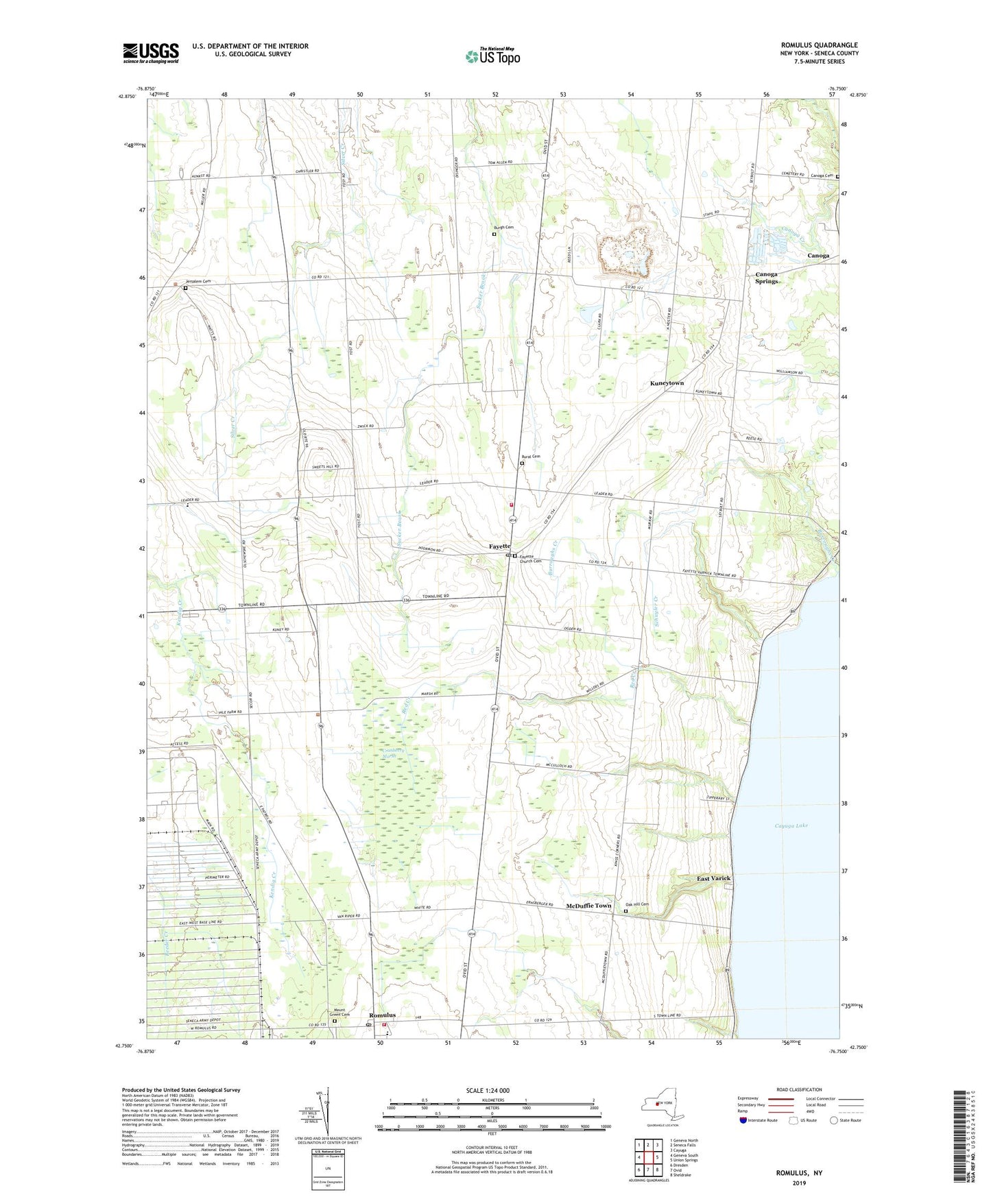
2023 topographic map quadrangle Romulus in the state of New York. Scale: 1:24000. Based on the newly updated USGS 7.5' US Topo map series, this map is in the following counties: Seneca. The map contains contour data, water features, and other items you are used to seeing on USGS maps, but also has updated roads and other features. This is the next generation of topographic maps. Printed on high-quality waterproof paper with UV fade-resistant inks.
Quads adjacent to this one:
West: Geneva South
Northwest: Geneva North
North: Seneca Falls
Northeast: Cayuga
East: Union Springs
Southeast: Sheldrake
South: Ovid
Southwest: Dresden
This map covers the same area as the classic USGS quad with code o42076g7.
Contains the following named places: Airtrek Airport, Burgh Cemetery, Burroughs Creek, Canoga Cemetery, Canoga Springs, Cassim Farm, Clemsons Corners, Cobblestone Farm Winery And Vineyard, Cranberry Marsh, East Varick, Fayette, Fayette Church Cemetery, Fayette Mennonite Church, Fayette Mennonite School, Fayette Post Office, Fayette Volunteer Fire Department, Goose Watch Winery, Jersalem Cemetery, Kings Corners, Knapp Winery, Kuneytown, Lakeshore Winery, McDonald Farm, McDuffie Town, Mount Green Cemetery, Oak Hill Cemetery, Peterman Farms, Red Creek, Romulus, Romulus Census Designated Place, Romulus Post Office, Romulus Presbytarian Church, Romulus Volunteer Fire Department, Rural Cemetery, School Number 11, School Number 12, School Number 13, School Number 3, School Number 4, School Number 5, School Number 6, Schuyler Creek, Seneca County, Seneca Mennonite Fellowship, Swedish Hill Vineyard, The Church of Jesus Christ of Latter Day Saints, Town of Fayette, Town of Varick, Varick United Methodist Church, WNYR-FM (Waterloo), Yost Corners, ZIP Code: 14541