MyTopo
Harrisburg New York US Topo Map
Couldn't load pickup availability
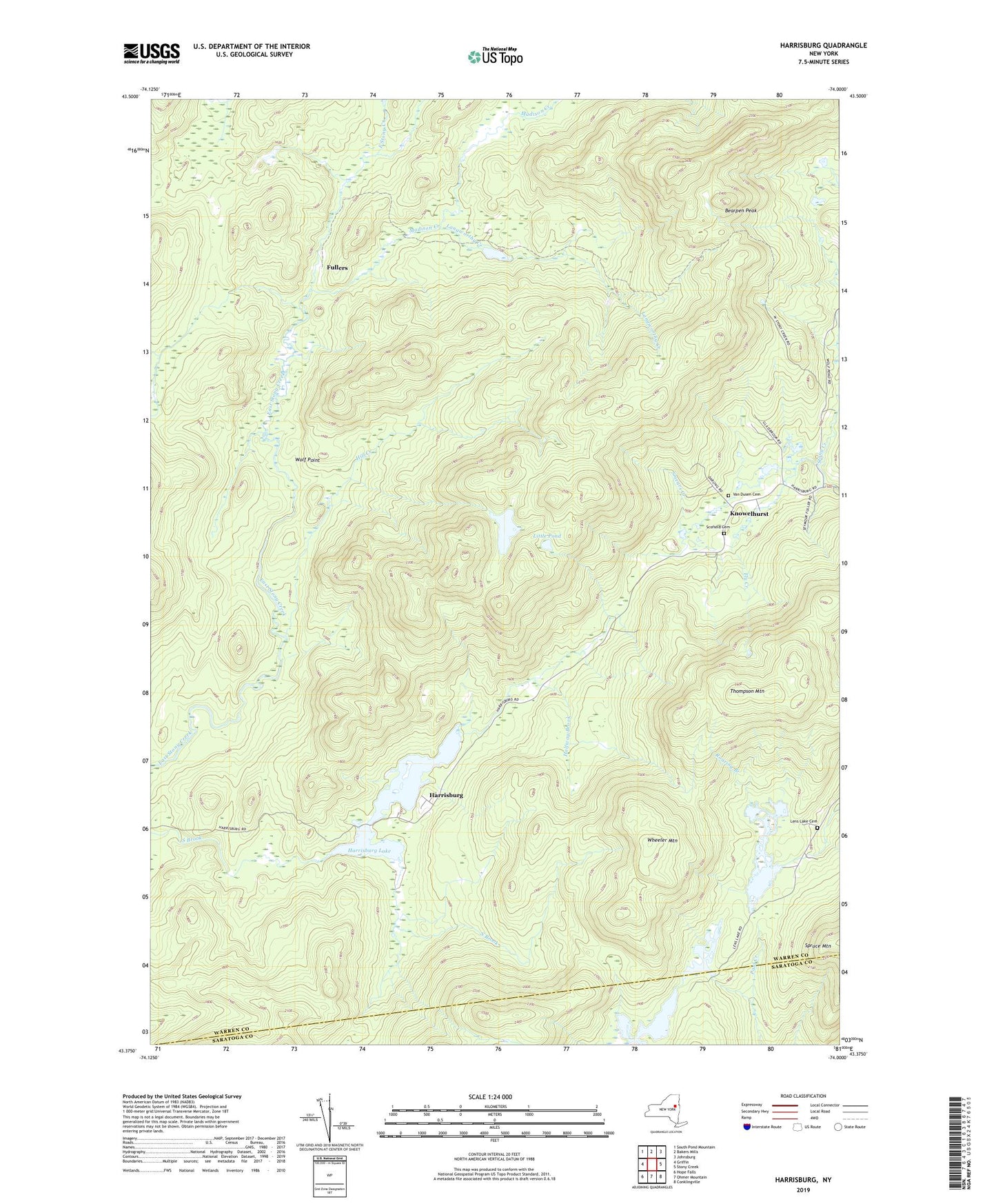
2019 topographic map quadrangle Harrisburg in the state of New York. Scale: 1:24000. Based on the newly updated USGS 7.5' US Topo map series, this map is in the following counties: Warren, Saratoga. The map contains contour data, water features, and other items you are used to seeing on USGS maps, but also has updated roads and other features. This is the next generation of topographic maps. Printed on high-quality waterproof paper with UV fade-resistant inks.
Quads adjacent to this one:
West: Griffin
Northwest: South Pond Mountain
North: Bakers Mills
Northeast: Johnsburg
East: Stony Creek
Southeast: Conklingville
South: Ohmer Mountain
Southwest: Hope Falls
Contains the following named places: Bearpen Peak, Fly Creek, Fullers, Halfway Brook, Harrisburg, Harrisburg Lake, Hill Creek, Knowelhurst, Knowlhurst Baptist Church, Langworthy Creek, Lens Lake, Lens Lake Cemetery, Little Pond, Madison Creek, Middle Flow, Saint John Lake, Scofield Cemetery, Smears Creek, Thompson Mountain, Town of Stony Creek, Van Dusen Cemetery, Wheeler Mountain, Wolf Point, ZIP Code: 12878